


0


| Thumbs Up |
| Received: 19,523 Given: 37,001 |
I made a thread about Lara state long ago, but it went ruined because many pics I posted in there got vanished, so I have to remake it again, like I have had to do with most other states...
Location of Lara state within the Venezuelan territory:
Politic map of the different municipalities of the state, so that those of you who want to know the exact location of pics and videos could look them up (the western areas marked with diagonal gray lines are areas in dispute with the neighboring states of Falcon, Zulia and Trujillo, and there is also a small area in dispute with Portuguesa in the very south that isn't shown in this map):
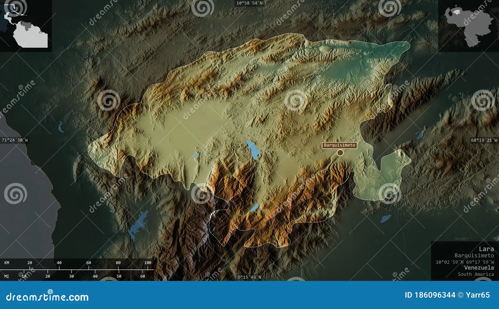
Relief map of the state showing details of roads, cities, towns, and differences in altitude. The green parts are the lowest parts of the state, while the orange areas are higher, and yellow areas have intermediate altitude. It also shows the areas in dispute with the neighboring states of Falcon, Zulia, Trujillo and Portuguesa:
Another relief map of the state showing the relief of the state more in perspective with the geography of the neighboring states: The mountains south of the state are the latest outskirts of the Andean range (in this case the Merida mountain range, which is the Venezuelan continuation of the cordillera oriental coming from Colombia), while the northern mountains are part of the Corian system (sistema coriano) which is a mountainous formation mostly shared by Lara and Falcon, and to a less extent Yaracuy and Zulia:
State Flag:
State coat of Arms:
Lara state, with a surface area of 19,800 square kilometers (almost the size of Israel), has roughly a bit more than 2,000,000 inhabitants according to the last census (2015). Barquisimeto (930,000 inhabitants, average altitude 640 meters above sea level), its capital, is the fourth Venezuelan largest city. The state took its name after the independence leader Jacinto Lara, who was from Carora, in current Lara state.
It limits to the north with Falcon state, to the south with Portuguesa and Trujillo, to the east with Yaracuy, to the southeast with Cojedes, and to the west with Zulia.
Most of the state topography consists on high plains and broken hills with a relatively hot and dry climate. The south and southwest of the state is dominated by the last foothills of the Andes, including the highest altitude in the state, the Cendé Paramo at 3,585 m above sea level. To the center of the state, there are the depressions of Carora (mostly colored in green on the first relief map) and Barquisimeto (mostly colored in yellow, on the first relief map). The Carora depression (in the west) is at an average altitude of 400 meters above sea level, while the "depression" in the east (I would consider it more like a high plain than as a depression, but is sometimes referred as depression for being obviously lower than the Andes in the south and the corian system in the north) where Barquisimeto, Quibor, Duaca, and other cities and towns are located, is at an average altitude of 700 meters above sea level. The Barquisimeto high plateau is excellent for human settlement, commerce and communication, while the Turbio River valley (south east of Barquisimeto, where the sattelite city of Cabudare is located) provides soils suitable for intense agriculture. North of the depressions of Carora and Barquisimeto, begins the mountanious system known as the Corian system (which I already mentioned in the thread of Falcon state), which extends mostly through northern Lara, Falcon, and to a less extent West/North western Yaracuy (sierra de Aroa) and the easternmost parts of Zulia state.
As a side note, Barquisimeto (the state capital) is in the foothills of the last northern outskirts of the Andean mountain range. The city is located right where the Andes begin. From here (south of Barquisimeto) the Andes begin their long journey down south up to the Patagonia and Tierra de Fuego.
Landscapes from this state on next post, and school/high school pics on the following posts. Thread opened...
Last edited by alnortedelsur; 10-16-2023 at 10:02 PM.
My Updated 23andme Results (2021)
My Updated AncestryDNA Results (2022)
My Global25 Coordinates (2020)
An Epic Thread about me opened by Profield
Originally Posted by Profileid

| Thumbs Up |
| Received: 19,523 Given: 37,001 |
Some landscapes of Lara state...
Barquisimeto as seen from the northwest, from a sierra that borders the city on its north:
Grape crops, close to the city of Carora (I think):
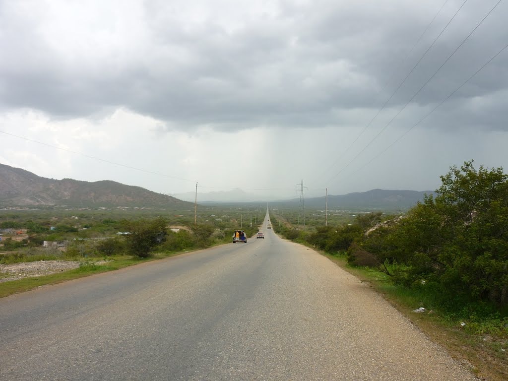
Roads in the typical landscapes of the high plateau where Barquisimeto, Quibor, Duaca, and other cities in eastern Lara are located:
Lomas de Cubiro, close to the locality of Cubiro, in the municipality of Jimenez, 57 kilometers south of Barquisimeto, in the Andes from Lara state:
Andean town of Humocaro Alto, in the municipality of Morán, in the very south of the state:
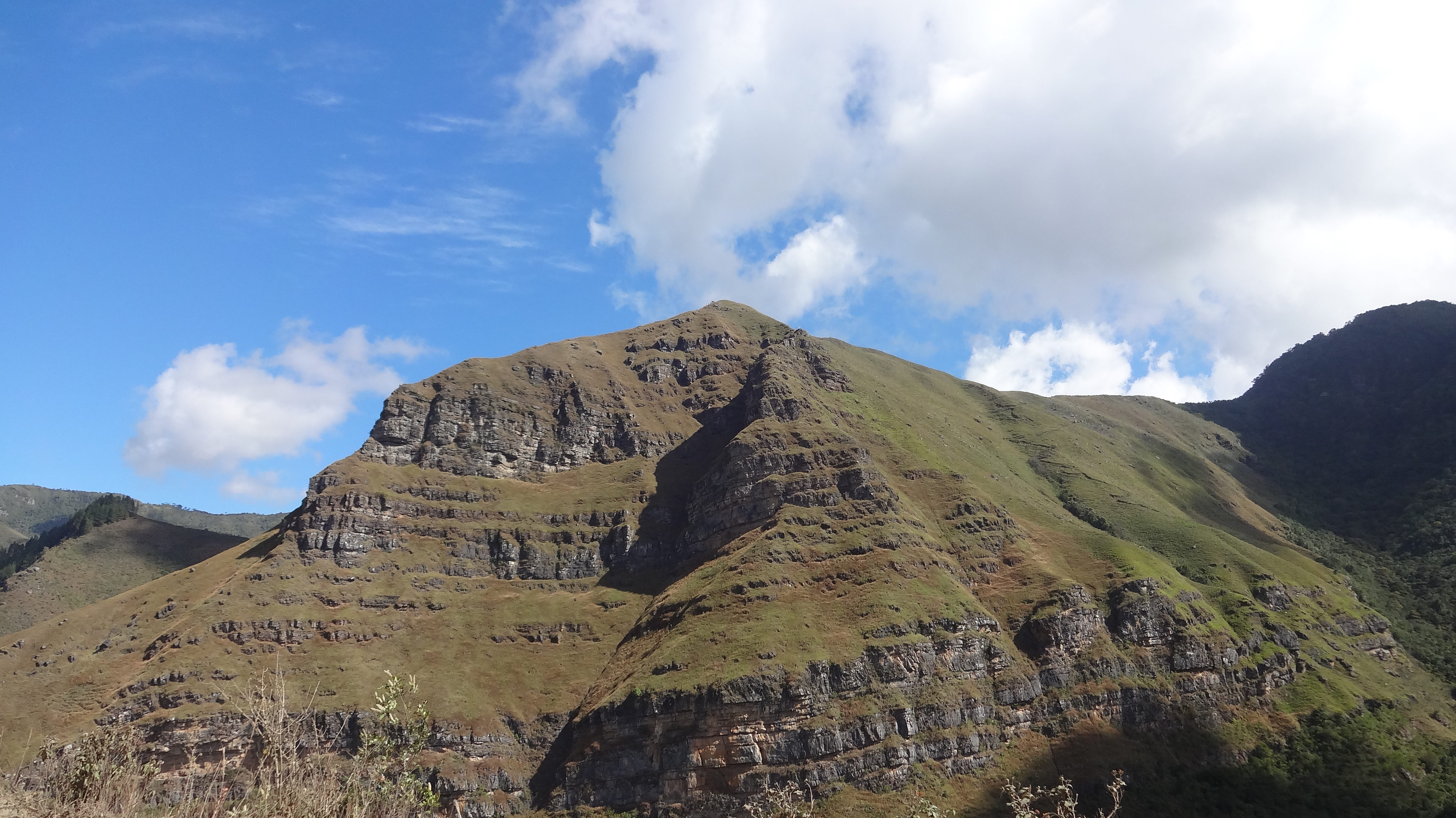
Andean mountains close to Humocaro Alto:
Cendé Paramo (3,585 neters above sea level), the highest elevation of the Larense Andes:
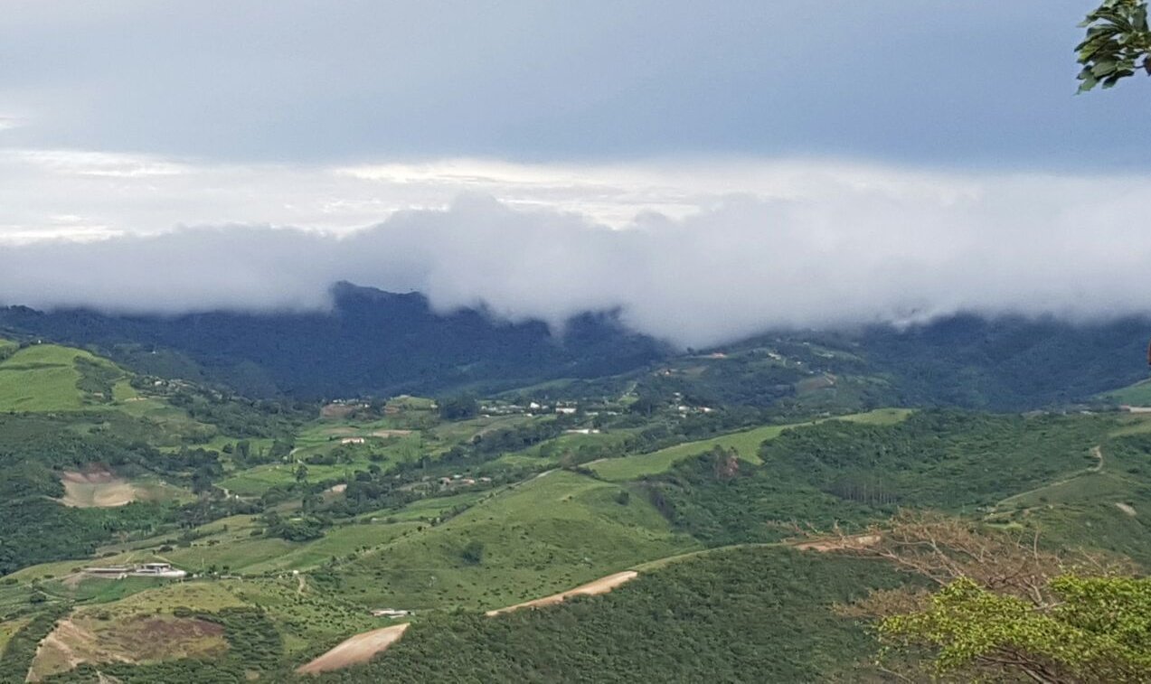
Andean landscapes in the outskirts of Andean city of Sanare (near to 60,000 inhabitatns, 1354 meters above sea level), in the municipality of Andres Eloy Blanco:

Last edited by alnortedelsur; 10-16-2023 at 08:47 PM.
My Updated 23andme Results (2021)
My Updated AncestryDNA Results (2022)
My Global25 Coordinates (2020)
An Epic Thread about me opened by Profield
| Thumbs Up |
| Received: 19,523 Given: 37,001 |
Before I start posting pics and videos of schools, high schools and different events... some landscapes from Barquisimeto, the state capital and fourth largest and most populated Venezuelan city. Barquisimeto is known as the sunset city (the sunsets in here are spectacular) and also as the musical capital of Venezuela. The lowest parts of this city (the very east of it) are like at an altitude of about 526 meters above sea level, while the westernmost parts of the city are at an altitude of around 700 meters above sea level, and one thing that is quite interesting is that most of the city is very plain, and yet as you move from east to west within the city, you feel like everything is very plain, while you don't realize that you are slowly increasing your altitude as you move from east to west:
The building with the shape of a cuatro (a Venezuelan guitar of 4 strings) is the Sambil Barquisimeto shopping center:
More pics from Barquisimeto:
Obelisk of Barquisimeto (built and inaugurated during the government of Marcos Perez Jimenez), is an emblem of the city:
Flower of Hanover (flor de Hanover) or flower of Venezuela, is an exposition center in the east side of the city (also known as triangulo del este):
Giant monument to divina pastora, patron saint of Barquisimeto:
Football (soccer) stadium of Barquisimeto. Actually is not located in Barquisimeto itself, but in the outskirts of Cabudare, a satellite city located few miles southeast of Barquisimeto. The football matches that took place in Barquisimeto during the Venezuelan copa America 2007 were held in this football stadium, and it is also the official stadium of Lara football club:

Last edited by alnortedelsur; 10-17-2023 at 04:14 PM.
My Updated 23andme Results (2021)
My Updated AncestryDNA Results (2022)
My Global25 Coordinates (2020)
An Epic Thread about me opened by Profield
| Thumbs Up |
| Received: 19,523 Given: 37,001 |
Location of Iribarren municipality within Lara state:
Area: 2760 sq kms
Population: 1,409.692 inhabitants
Average altitude: 566 meters above sea level
Capital: Barquisimeto (1,173.095)
Is the same municipality where the state capital, Barquisimeto, is located.
The following few pics are from the Bolivarian (public) high school Tamaca, located in the town of the same name (Tamaca) that is at roughly 600 meters above sea level, and few miles north of Barquisimeto:
Last edited by alnortedelsur; 10-17-2023 at 04:40 PM.
My Updated 23andme Results (2021)
My Updated AncestryDNA Results (2022)
My Global25 Coordinates (2020)
An Epic Thread about me opened by Profield
| Thumbs Up |
| Received: 19,523 Given: 37,001 |
More pics from the Bolivarian (public) high school Tamaca, located in the parish of Tamaca, few miles north of Barquisimeto, in Lara state:

My Updated 23andme Results (2021)
My Updated AncestryDNA Results (2022)
My Global25 Coordinates (2020)
An Epic Thread about me opened by Profield
| Thumbs Up |
| Received: 19,523 Given: 37,001 |
La siguiente tanda de imagenes corresponde con la escuela Bolivariana (y por lo tanto publica) y de educacion primaria, Ciudad de Maturin, localizada en Barquisimeto, estado Lara:

My Updated 23andme Results (2021)
My Updated AncestryDNA Results (2022)
My Global25 Coordinates (2020)
An Epic Thread about me opened by Profield
| Thumbs Up |
| Received: 19,523 Given: 37,001 |
A partir de ahora unos pocos videos para acabar la pagina antes de seguir con el siguiente plantel educativo. No me gusta poner tandas de fotos al final de pagina donde nadie las va a ver, y ademas demasiadas fotos saturan las paginas...
Video algo viejo, pero igual valido, de un canal de youtube de la alcaldia del municipio Iribarren (donde se ecuentra Barquisimeto).
Becas estudiantiles para jovenes estudiantes Barquisimetanos (montones de estudiantes en el video):
Avenida 20 de Barquisimeto, es una importante avenida de Barquisimeto, conocida por su intensa actividad comercial (bastante gente puede apreciarse en el video):
My Updated 23andme Results (2021)
My Updated AncestryDNA Results (2022)
My Global25 Coordinates (2020)
An Epic Thread about me opened by Profield
| Thumbs Up |
| Received: 19,523 Given: 37,001 |
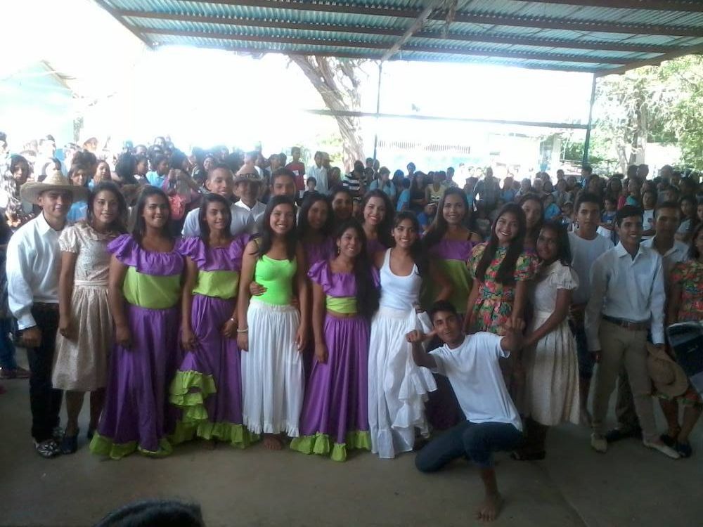
Evento masivo en la feria internacional de Barquisimeto:
My Updated 23andme Results (2021)
My Updated AncestryDNA Results (2022)
My Global25 Coordinates (2020)
An Epic Thread about me opened by Profield
| Thumbs Up |
| Received: 19,523 Given: 37,001 |
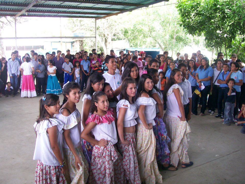
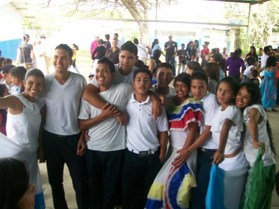
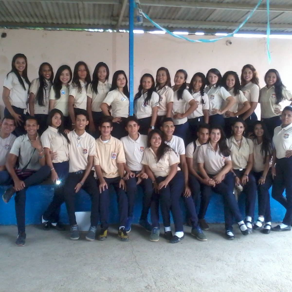
High school students from Carora, a small city in Western Lara of around 250,000 inhabitants, and located at an altitude of 419 meters above the sea level, in the municipality of Torres (see map):
Last edited by alnortedelsur; 10-18-2023 at 12:42 AM.
My Updated 23andme Results (2021)
My Updated AncestryDNA Results (2022)
My Global25 Coordinates (2020)
An Epic Thread about me opened by Profield


| Thumbs Up |
| Received: 26,286 Given: 43,807 |
Me parece que hay un poco de todo, pero en comparacion con otras regiones que has mostrado, creo que hay mas extremos tanto de blancos (o euro-mestizos) como de negros y trirraciales-afros.
There are currently 1 users browsing this thread. (0 members and 1 guests)
 Latin America
Latin America
Latin America
Latin America
Latin America
Latin America
Latin America
Latin America
Latin America
 Posting Permissions


 Reply With Quote
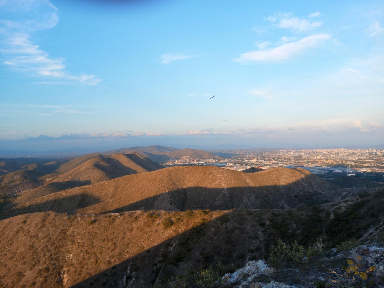


Bookmarks