


 Nederland
1


| Thumbs Up |
| Received: 34,729 Given: 61,129 |
In West-Brabant:
Oudenbosch met zijn basiliek dat werd opgetrokken als een monument voor de Nederlandse katholieken die in 1870 als vrijwillige Pauselijke Zoeaven voor de verdediging van de Kerkelijke Staat in Italië hebben gevochten.
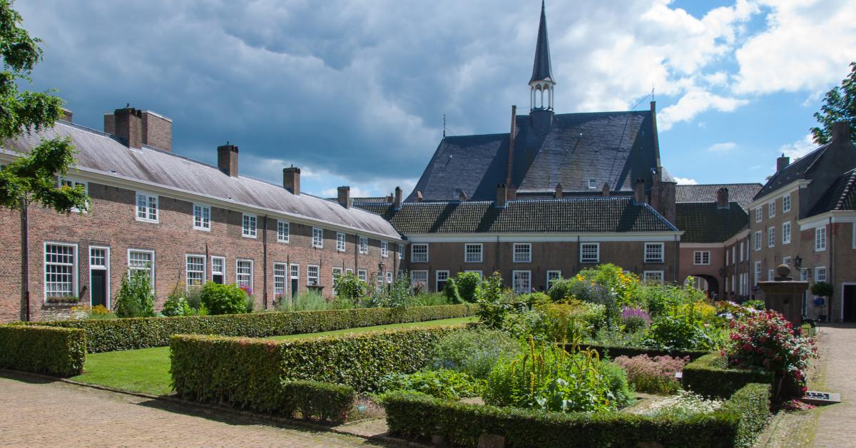
Het Begijnhof van Breda:
De andere kant van het Begijnhof:
Het kasteel van Breda - nu Koninklijke Militaire Academie:
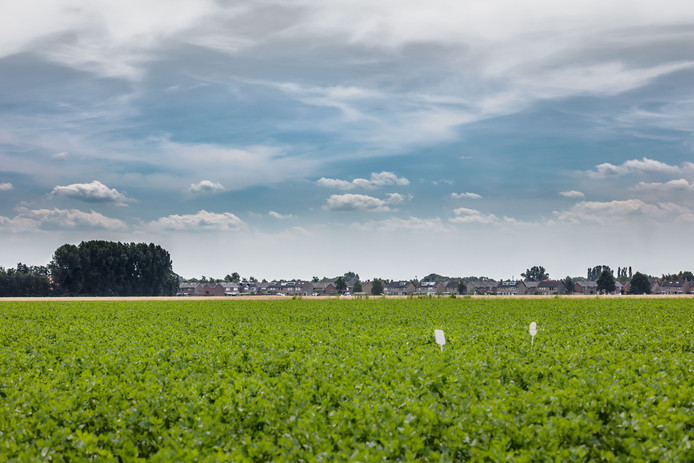
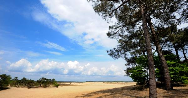
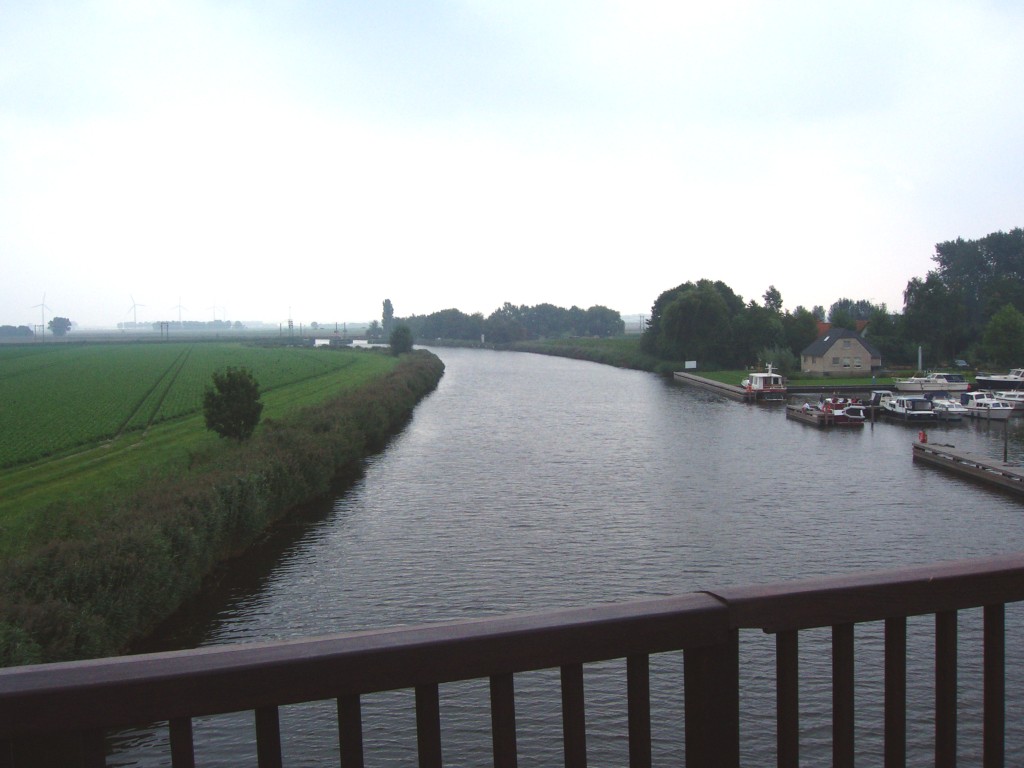
Een rustig landschap:
Wake up and smell the coffee.
| Thumbs Up |
| Received: 34,729 Given: 61,129 |
Look over the shoulder of an train driver on the route from Baarn to Utrecht Centraal. This sprinter train stops at Soestdijk, Soest, Soest south, Den Dolder, Bilthoven and Utrecht Overvecht.
Wake up and smell the coffee.
| Thumbs Up |
| Received: 34,729 Given: 61,129 |
Look over the shoulder of a train driver on his way with the intercity on the route from 'S-Hertogenbosch, via the Flying junction of Lunetten, on his way to Alkmaar.
Wake up and smell the coffee.
| Thumbs Up |
| Received: 34,729 Given: 61,129 |
Den Haag in 1975:
De Nederlanden van 1845 (toen in gebruik als het kantoor van het Gewest 's-Gravenhage dat tussen 1973 en 2002 het beleid tussen Den Haag en de omliggende regio heeft gecoordineerd en als overlegorgaan fungeerde) aan het Kerkplein 1-3 - tegenover het oude stadhuis (wat toen allang niet meer in gebruik was: het stadhuis zetelde toen aan het Monchyplein - niet ver van de Archipelbuurt) Hetzelfde uitzicht in juni 2018.
Piet Heinplein 5 - de prachtige panden van de voormalige abriek en woonhuis van de Koninklijke Nederlandse Meubelfabriek H.P. Mutters & Zn N.V. (1816-1970) Een bedrijf met een lange geschiedenis die, onder andere, de KLM het Congresgebouw en bekende hotels als De Twee Doelen en Des Indes van meubels heeft voorzien. De firma sloot zijn deuren in 1970. Hier een tweede foto uit 1924 met het kenmerkende pand dat veel aan het Mauritshuis deed denken. Vrijwel dezelfde locatie in april 2019.
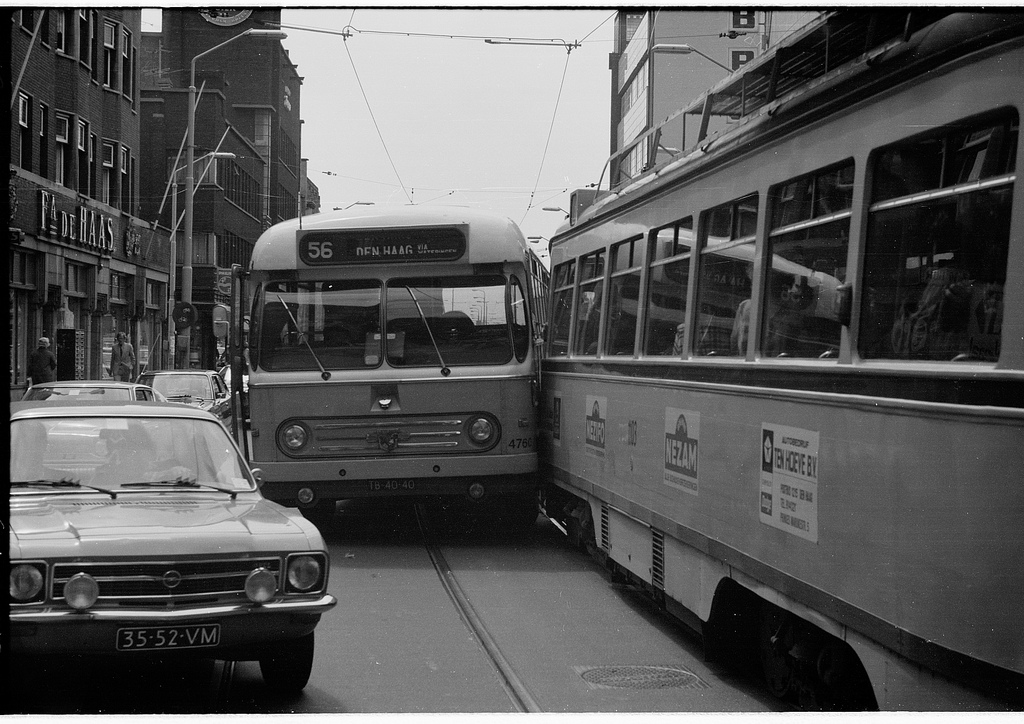
13 juni 1975: Soms zit het mee maar soms ook niet; Een bus van Westnederland -een bedrijf dat actief was tussen 1969 en 1994 - (type: Leyland-Werkspoor A-Road) en een Haagse PCC van de HTM wisselen zoentjes uit in de Grote Marktstraat. Dezelfde locatie in juni 2018.
Terug naar 1994 - treinen van de Nederlandse Spoorwegen:
In de jaren 90 van de vorige eeuw bracht RailArt elk jaar twee Railjournaals uit. Uit de uitgave van 1994 hebben wij korte spooritems onder de naam Railflitsen bij elkaar gebracht.
Railflits 1 - Station Woerden Verbouwing van het station Woerden in de jaren 90.
Railflits 2 – De rode 6500 van NS Cargo NS 6511 was de eerste rode 6500 van NS Cargo toen nog een dochter van de Nederlandse Spoorwegen.
Railflits 3 – Railhoppers weer op het goede spoor In de werkplaats Zwolle worden de SM 90 stellen onder handen genomen.
Railflits 4 – M2 rijtuigen weer terug naar België De laatste inzetten van de gehuurde Belgische M2 rijtuigen.
Railflits 5 – Nieuwe NS Regiorunners in bedrijf 26 mei 1994 werd het eerste treinstel van het dubbeldeks interregiomaterieel aan de NS overgedragen.
Wake up and smell the coffee.
| Thumbs Up |
| Received: 34,729 Given: 61,129 |
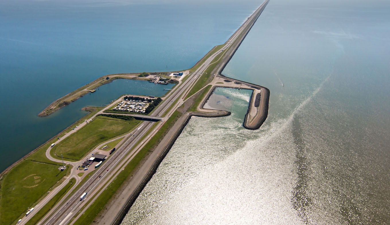
Note that his video is being criticised by a Dutch commenter:The number 350 bus from Leeuwarden to Alkmaar takes an unusual route: straight across 32 kilometres of sea. I hopped on board for a visit to the famous Afsluitdijk. (If you'd like to learn more about the story of the Afsluitdijk there's a great video here which goes into much more detail):
Arnold Grashoff 4 months ago (edited)
You are missing the point that the river IJssel is flooding from the Alps into the IJsselmeer, by Ketelmeer. You cannot drain the IJsselmeer, because it is constantly fed by fresh water from the Alps, in particular in the spring when the snow is melting. Inside the Ketelmeer there is a special island built, IJsseloog, for deposing environmental contaminated dredging sludge. There are special dredging programs ongoing. Due to the loss of current force at this location, most environmental contaminated particles from the river settle down here to the lake floor. When the level of the river IJssel is extremely high, a state-of-art flexible barrier is placed at Ramspol, to prevent entire back-country side is overflooded and agriculture is damaged by too much water. There are pumps in the Afsluitdijk that are pumping the water out towards the Waddenzee, faster or slower. A certain level inside the IJsselmeer is maintained. Actually, the entire freshwater in the IJsselmeer is a huge freshwater storage for the entire region of Noord-Holland, Friesland, Groningen, Overijssel, Flevoland, etc. for agriculture use (you can not use salt seawater for agriculture). The Afsluitdijk is under maintenance, after 80 years it is not leaking; the outer part will be reinforced with state-of-art, marine ingenuity, designed concrete blocks to make it superstorm proof (as part of a reinforcement program already initiated many years ago, rolled out over the entire country). Further, as well pumps will be installed, in the natural out flooding sluices electric power generators will be placed, power generators based on salt and freshwater will be built, and a new fish transfer river (the first one in the world of this scale) will be built, so fish can migrate into the freshwater part to breed, what was the situation in all the centuries before the Afsluitdijk was built. Side note, this is not the first type, there is a small one as an example at Nieuwe Statenzijl close to the Kiekkaaste with a stunning view over Dollard. There is another huge dike, Markerwaarddijk from Lelystad to Enkhuizen. North of the Markerwaarddijk is the IJsselmeer and south of it the Markermeer. If you like to drain something, you could perhaps use the Markermeer for this, but so far that is not planned. On google maps, you can recognize a huge difference in color between both lakes. Both lakes are freshwater, the difference of color is not caused by a difference in salinity, the cause is algae. IJsselmeer contains high-quality freshwater, fit for agriculture use. Markermeer contains freshwater of less quality. On google maps, you can find inside the Markermeer newly installed islands (close the Markerwaarddijk), which have the purpose to clean the water inside the lake by natural means. The majority of winds over the Markermeer in relation to the new island, are from SW and W-ly direction, causing a surface current in the water, passing these islands. Due to the presence of certain vegetation and present of certain animals, birds, etc. the quality of the water must increase over the coming decades. It has the intention that underwater life must benefit from this and thrive as well. Please be invited to take your time to have a check on this video as well
This video shows an improved 3D impression of the Fish Migration River. Research en development have resulted into a new design. The fishmigrationriver is a unique concept that will enable fish to migrate from the Wadden Sea to the IJsselmeer and back while preventing salt water to enter the freshwater basin. The construction of the Afsluitdijk in 1932 resulted in an ecological disaster for the Wadden Sea and the Zuiderzee .The Zuiderzee's mix of brackish and salt water became purely fresh water. The tide disappeared. And also the migratory fish species suddenly found the route to their Zuiderzee spawning grounds blocked. These fish species used to mate in the brackish water of the Zuiderzee. After the Afsluitdijk was constructed, their populations collapsed. The Directorate of Public Works and Water Management is now planning major maintenance works for the Afsluitdijk, starting in 2016. The dike will be strengthened and reinforced. Regional stakeholders are seizing this opportunity to put forward this plan for the restoration of the ecological balance. And, at the same time, to improve the quality of nature reserves and recreational areas. No other country has anything like this Fish Migration River, although about 200 comparable situations exist throughout the world. By investing now in further development of the Fish Migration River, the Dutch water management sector will acquire unique expertise. Therefore, the Fish Migration River also has international potential.
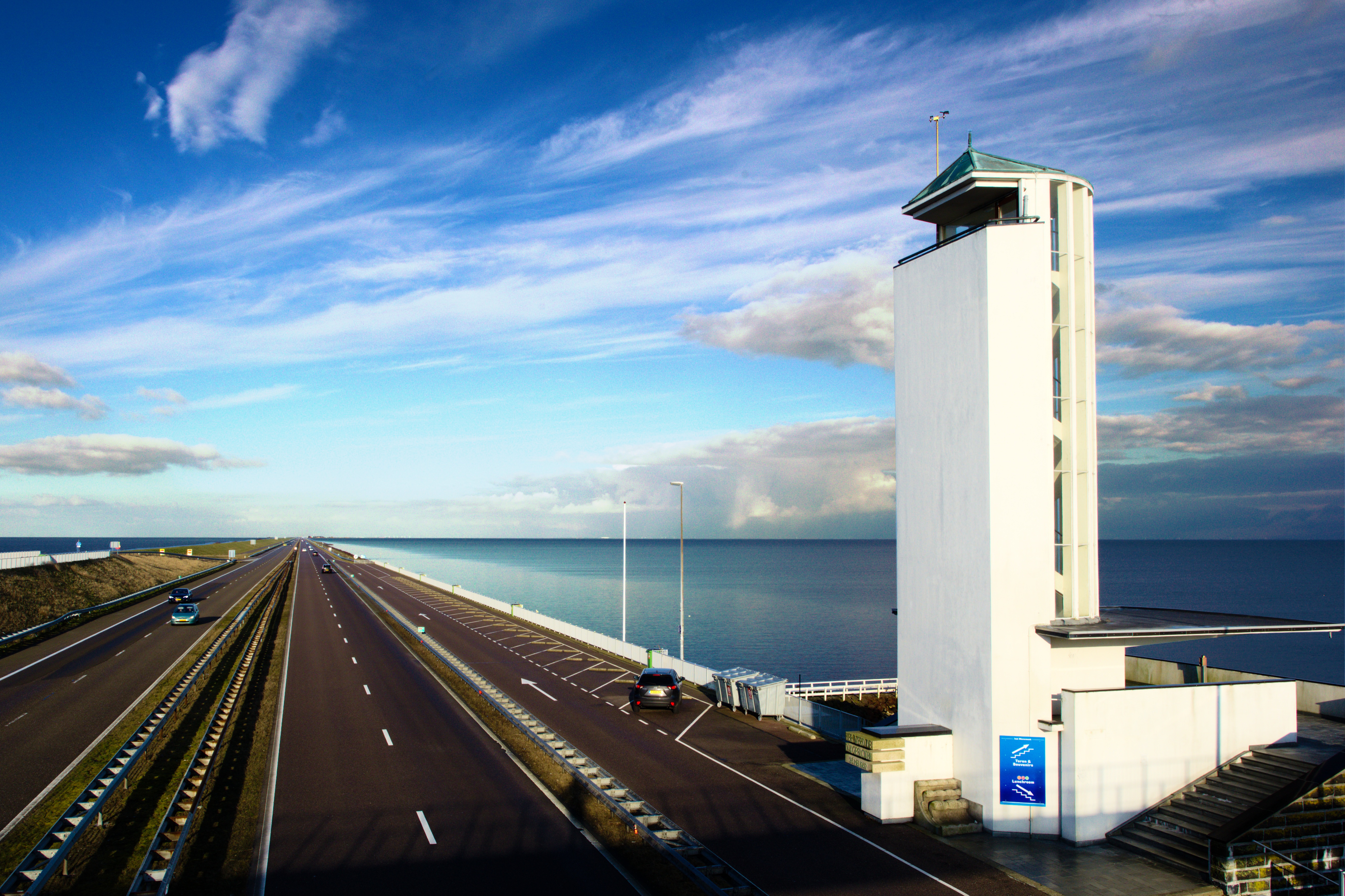
The Afsluitdijk is the 32 kilometer long dam which protects the Netherlands against water and flooding. Built mostly by hand in 1932 it is an engineering highlight of the Netherlands and an unique place in the world. Now after almost 100 years the Afsluitdijk is in need of a thorough renovation. The Dutch state together with the surrounding municipalities and provinces have joined forces to lead an ambitious programme to protect and safeguard the future of the dam. Part of this renovation is Daan Roosegaarde’s ICOON AFSLUITDIJK appointed by the Dutch Ministry of Infrastructure and Environment. ICOON AFSLUITDIJK will create a subtle second layer of light and interaction which enhances the Afsluitdijk unique experience between man and landscape. Roosegaarde designs will be of both temporal and permanent nature and will be revealed gradually. Roosegaarde will take us on a journey from the past into the future in three distinct chapters lasting over a period of more than two years. The programme will kick off its first chapter in the late summer of 2016 with festive activities reflecting the innovative and sustainable character of the Afsluitdijk. In collaboration with Daan Roosegaarde and his Studio Roosegaarde, Rijkswaterstaat, Ministry of Education, Culture and Science, Provence of Friesland, Provence of North Holland, Universities, external contractors and other designers the project aims to become an international showcase for the Netherlands as leader in Dutch Design and sustainable solutions of tomorrow. http://www.denieuweafsluitdijk.nl - https://www.studioroosegaarde.net
Op de Afsluitdijk werden donderdag drie grote lichtkunstwerken geopend. Automobilisten hoeven echter niet bang te zijn om verblind te raken, verzekert Rijkswaterstaat.
Artwork about the power and poetry of water. www.studioroosegaarde.net
Last edited by The Lawspeaker; 12-02-2019 at 02:43 PM.
Wake up and smell the coffee.


| Thumbs Up |
| Received: 25,558 Given: 27,896 |
The Dutch are masters in their knowledge of preventing floods considering how low their land is in relation to the sea level, and large tides coming in from the North Sea. I think their ability to reclaim land from the sea in order to create Flevoland is quite astonishing and impressive.
Last edited by ♥ Lily ♥; 12-19-2019 at 03:51 PM.
❀♫ ღ ♬ ♪ And the angle of the sun changed it all. ❀¸.*¨♥✿ 🎶
| Thumbs Up |
| Received: 34,729 Given: 61,129 |
A compilation of footage of the Netherlands (Nederland) taken during the 1920s / jaren 20
The villages and cities seen in the video:
Alkmaar
Amsterdam
Den Haag (Scheveningen)
Dordrecht
Groningen
Leeuwarden
Leiden
Marken
Rotterdam
Hoogeveen
Schoonhoven
Winterswijk
Zeist
Music
Erik Satie - Gymnopédie No.1
Claude Debussy - Clair de Lune
Frédéric Chopin - Nocturnes, Op. 9
Een kijk in het leven op Marken met de opvallende klederdracht, karakteristieke houten huizen op palen en souvenirverkoopster Sijtje Boes. Duik dieper de collectie in! Veel meer prachtig archiefbeeld zie je op http://in.beeldengeluid.nl
Wake up and smell the coffee.
| Thumbs Up |
| Received: 25,558 Given: 27,896 |
Northern Lights (Aurora Borealis) in the Netherlands.
❀♫ ღ ♬ ♪ And the angle of the sun changed it all. ❀¸.*¨♥✿ 🎶
| Thumbs Up |
| Received: 34,729 Given: 61,129 |
This particular VIRM is hopelessly outdated and they are undergoing refurbishment between the 2016 and 2020.Hi everyone, welcome to this trip report bound to Rotterdam Central with NS Intercity and their famous double decker VIRM.
TRIP INFORMATION -
Railway company:
NS Intercity Train type : VIRM
From : Roosendaal to Rotterdam Central
N° of train: Unknown
Duration : 0h38
Price : 11€
Wake up and smell the coffee.
| Thumbs Up |
| Received: 25,558 Given: 27,896 |
❀♫ ღ ♬ ♪ And the angle of the sun changed it all. ❀¸.*¨♥✿ 🎶
There are currently 1 users browsing this thread. (0 members and 1 guests)
 Posting Permissions


 Reply With Quote


Bookmarks