


 Latin America
9


| Thumbs Up |
| Received: 19,496 Given: 36,934 |
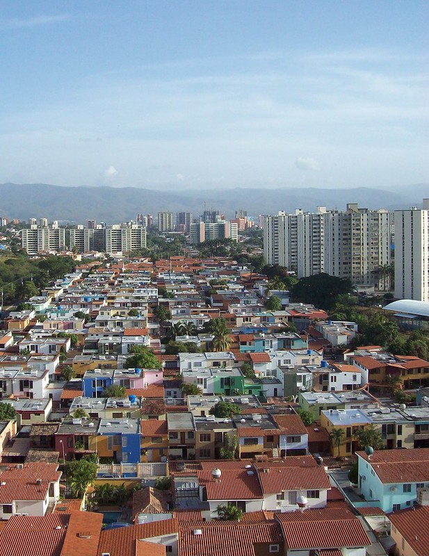
Barquisimeto, the capital of Lara state, in central western Venezuela, is the 4th most populated and most important Venezuelan city (more than 800,000 inhabitants). It is one of my top favorite Venezuelan cities, because is very clean and organized, and is IMO the best planned Venezuelan city (even better planned than Guayana City, in Bolivar state). I also like it, because it has a good standard of living, and have nothing to envy on its level of infrastructure, services, and entertainment, compared to the three major Venezuelan cities of Caracas, Maracaibo and Valencia. Additionally, it enjoys a relatively temperate climate, since it is located at more than 600 mts (2,040 feet) over the sea level.
Barquisimeto is located on a high plateau that is right on the exact location where the Venezuelan Andes begins its long journey towards the Southwest, change its name to Cordillera Oriental (eastern range) in Colombia, and continues its long journey down south, down to the Patagonia, in southernmost South America.
Barquisimeto was founded in 1552 by the Spaniard Juan de Villegas, and its original name was Nueva Segovia de Barquisimeto.
Origins of the name Barquisimeto:
According to the German adventurer Nikolaus Federmann, the Caquetío aborigines used to call it Variquicimeto, which translates as "ash-colored river", the name with which the natives distinguished the water stream near the city. This river was named "Turbio River" by the Spanish conquerors, a name that is still in use today. Another possible name origin is due to a red dye called bariquí.
When Juan de Villegas founded it, he named the city "Nueva Segovia de Barquisimeto", but years later it became just "Barquisimeto", a word popularized by Oviedo y Baños in his book History and Conquest of the Venezuelan Population.
Some Important Data from this Venezuelan city
Geography
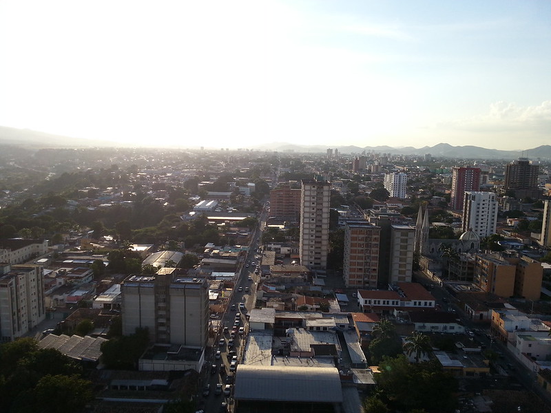
ClimateBarquisimeto is located on the terrace of the same name, on the banks of the Turbio River, 622 metres (2,040 feet) above sea level and a population that exceeds 800,000 inhabitants. It has a location on the central western of Venezuela (363 km (226 mi) from Caracas, the country's capital city), being a point of convergence of many of the major land routes and rail, characterized also by its street order and appropriate signage due to the location of the city with a relief almost completely flat, which facilitated the distribution of the urban grid and with the streets numbered in ascending numerical order, factors that help the foreign citizen and easily locate addresses
TransportationIn the city, the cool climate is dominant. Located in that region, Barquisimeto records 650 mm (25.6 in) of rain per year and its average temperature ranges 19 °C (66 °F).
Although, in higher regions near the Andes, temperatures are lower and the rain is more constant. For instance, in Sanare city, the annual index of precipitations is 835 mm (32.9 in).
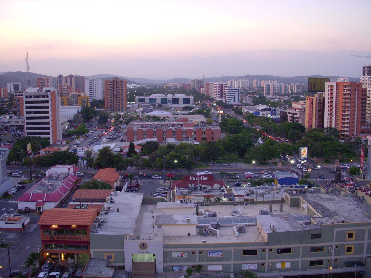
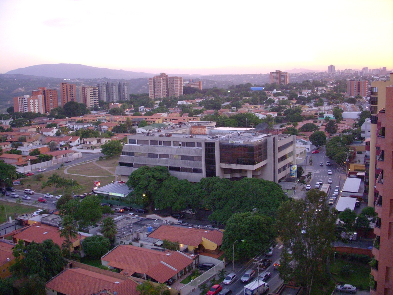
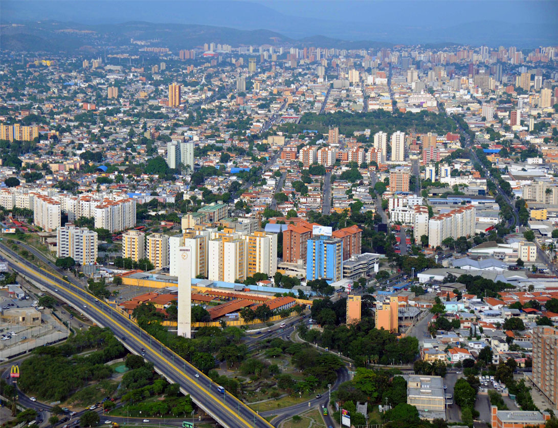
Here, some pics from Barquisimeto:The mode of transportation most commonly used are the “rapiditos”, old automobiles with an average capacity of 5 passengers, with a route similar to the buses and used mainly to shuttle people between downtown and the suburbs, like the shared cabs in other countries.
The Transbarca trolleybus system is a new "bus rapid transit" (BRT) system under construction. It is projected to serve an average of 170,000 people per day, using 80 trolleybuses operating along 30 km (19 mi) of exclusive lanes, across the metropolitan area. Service is planned to include an express route of 22 km (14 mi) along with one local route of 8 km (5 mi). With 52 stations, the trolleybus BRT system is to include a centralized system of communication and security, and structures for easy access for elderly and disability people. Also, it has 18 electrical substations. It is to be complemented with feeder routes, covering the areas of Greater Barquisimeto the trolleybus line will not serve, which will connect with the trolleybuses at terminal stations.
Buses are the main means of mass transportation. The system runs a variety of bus types, operated by several companies on normal streets and avenues:
bus; large buses.
buseta; medium-sized buses.
microbus or colectivo; vans or minivans.
rapiditos; old cars with capacity for 5 or more people.
The airport is called Jacinto Lara International Airport.
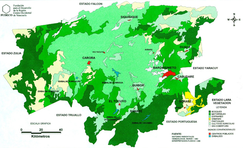
Location of Lara State:
Location of the city within Lara state (in the east):
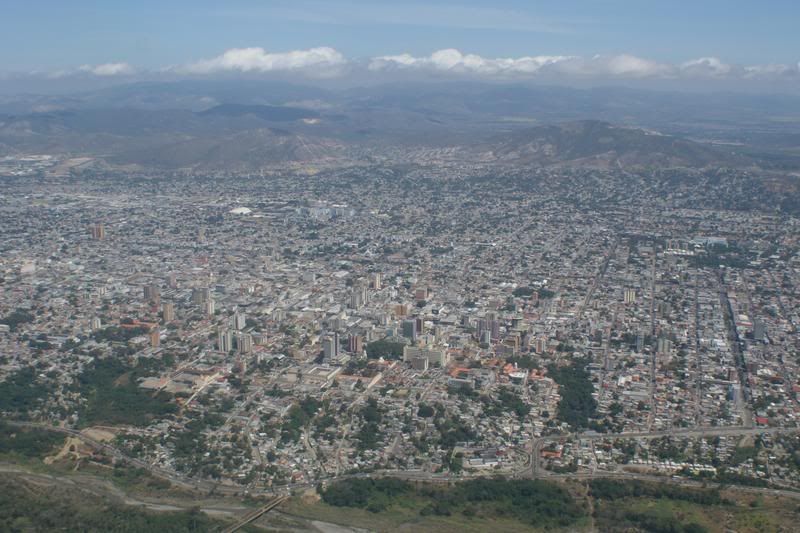
Plane of the city:
Pictures:
Opinions??
Last edited by alnortedelsur; 07-30-2015 at 11:26 PM.
| Thumbs Up |
| Received: 19,496 Given: 36,934 |
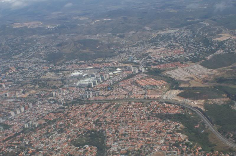
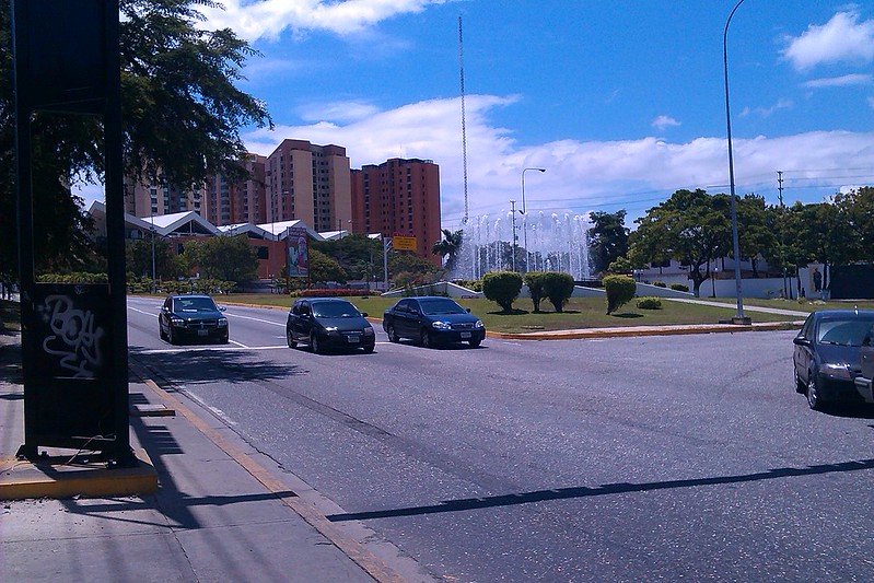
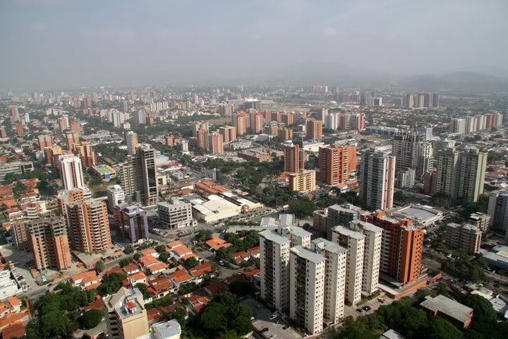
More pictures of this beautiful Venezuelan city:
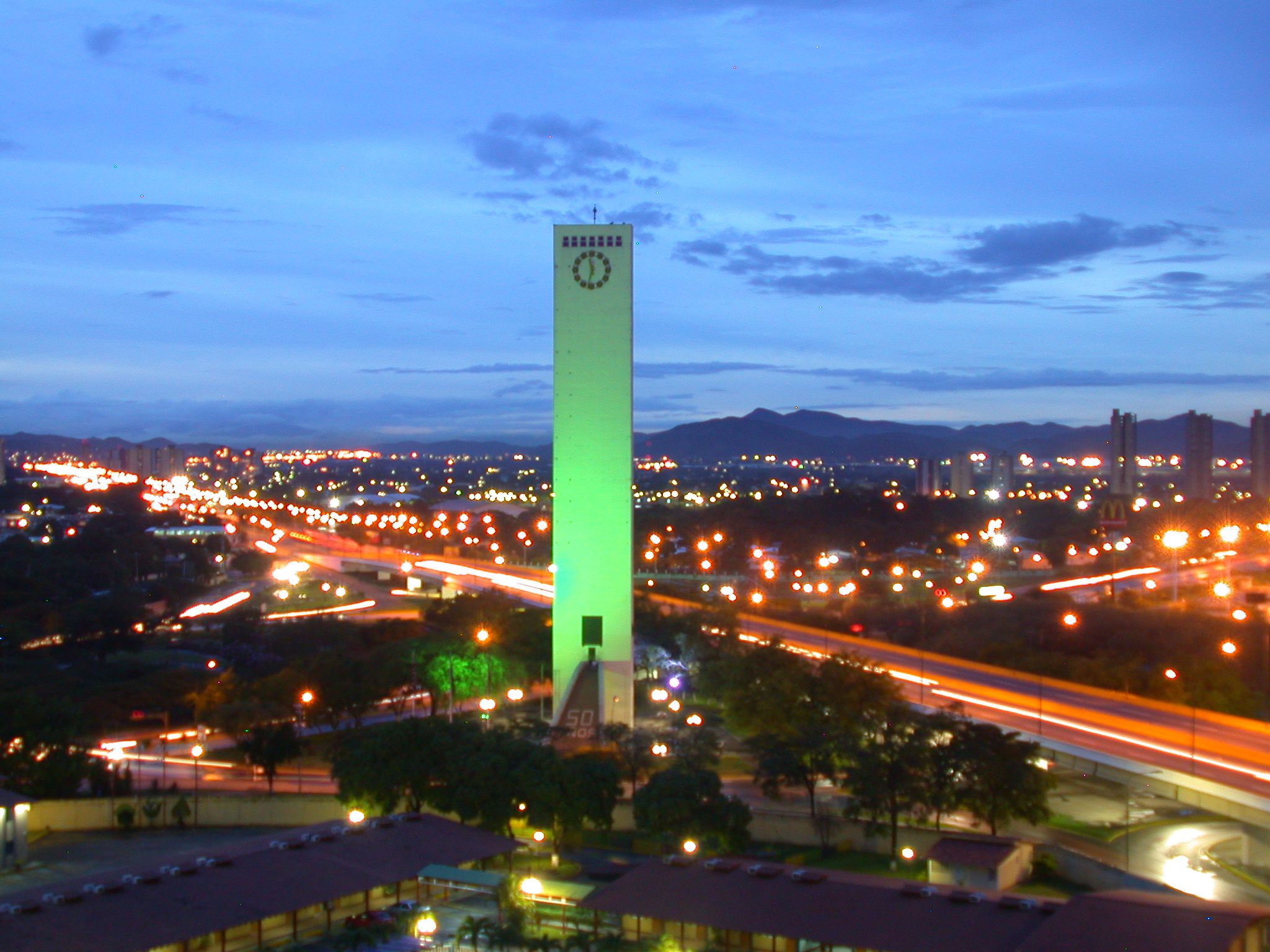
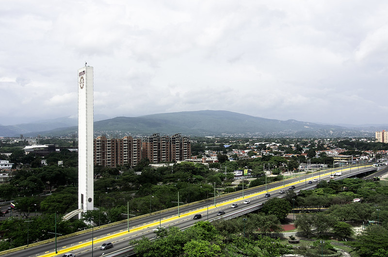
The Obelisk is one of the main symbols of the city:
Social Housing (viviendas de interes social):


| Thumbs Up |
| Received: 4,467 Given: 3,569 |
Interesting, thanks!
| Thumbs Up |
| Received: 1,538 Given: 1,428 |
Looks like an American city.
| Thumbs Up |
| Received: 19,496 Given: 36,934 |
Thank you all.
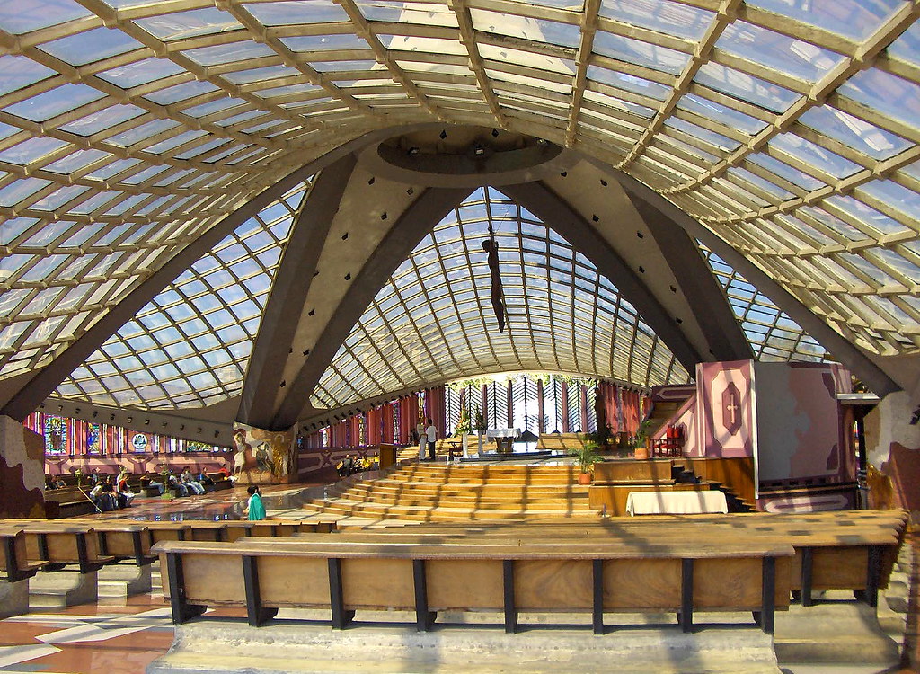
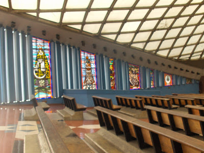
Different shots from the Obelisk of Barquisimeto:

Last edited by alnortedelsur; 08-02-2015 at 06:08 PM.
| Thumbs Up |
| Received: 19,496 Given: 36,934 |
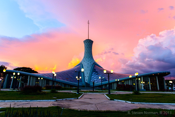
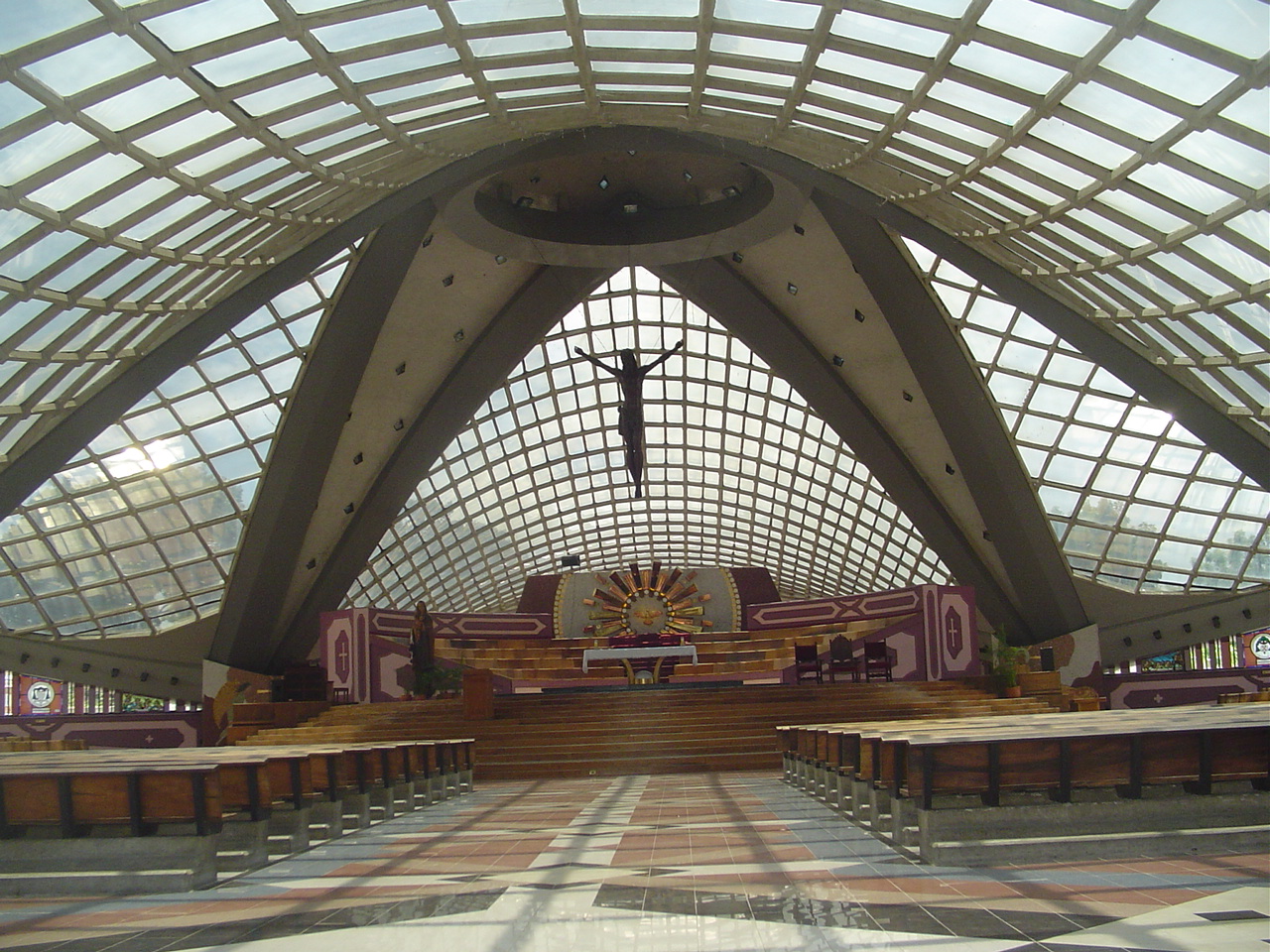
The Cathedral "Divina Pastora", of Vanguardist style, as it can be seen, is another icon from Barquisimeto
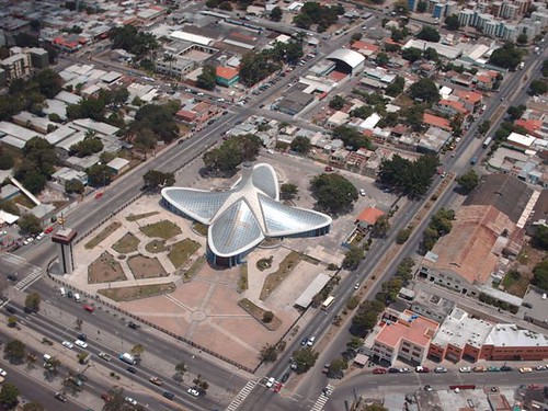
Last edited by alnortedelsur; 08-02-2015 at 06:44 PM.
| Thumbs Up |
| Received: 19,496 Given: 36,934 |
A couple of nice videos from Barquisimeto, as seen from the air:
| Thumbs Up |
| Received: 19,496 Given: 36,934 |
Some more pics of Barquisimeto (Lara):
Transbarca: is the name of the BRT system from Barquisimeto:


| Thumbs Up |
| Received: 7,874 Given: 12,909 |
Barquisimeto has alot of skyscrappers for it's size.
| Thumbs Up |
| Received: 19,496 Given: 36,934 |
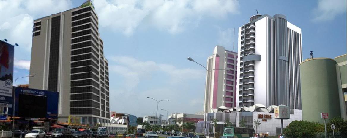
Render of future buildings in Barquisimeto:
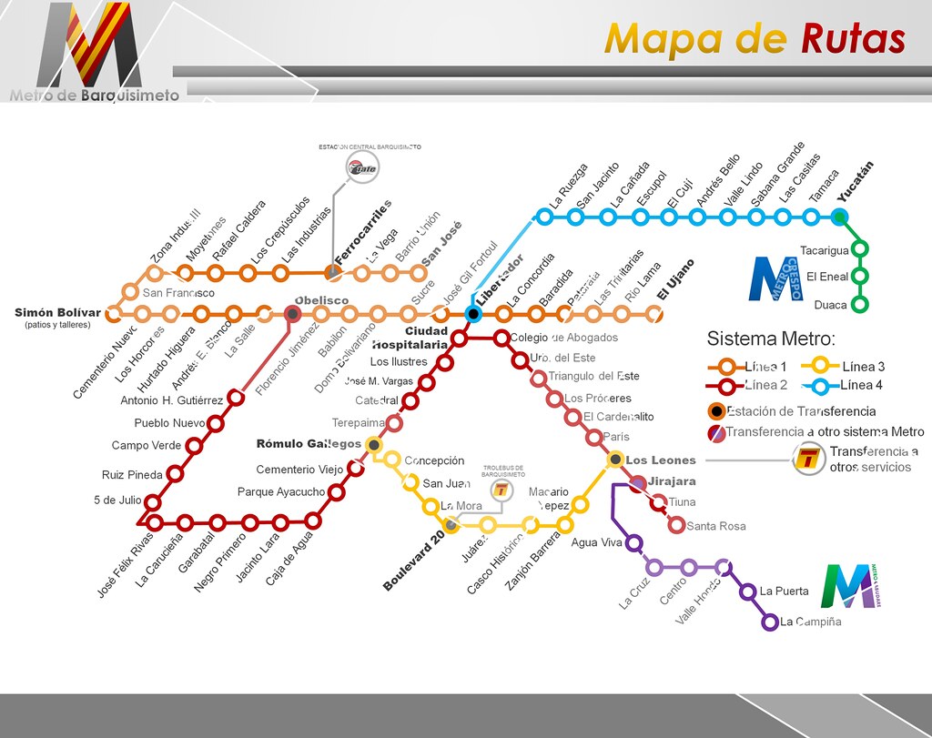
Project of future subway system in Barquisimeto:
There are currently 1 users browsing this thread. (0 members and 1 guests)
 Posting Permissions


 Reply With Quote


Bookmarks