

2


| Thumbs Up |
| Received: 35,722 Given: 17,037 |
Leo Belgicus: the map in the shape of a lion that symbolized the Low Countries
Source: http://www.thevintagenews.com/2017/0...low-countries/
The Leo Belgicus (the Belgic Lion) was used in both heraldry and map design to symbolize the Low Countries Netherlands, Luxembourg, and Belgium in the shape of a lion.
The name of this lion map derived from the Belgae ( a large confederation of tribes living in northern Gaul) and now is mostly identified with Belgium. Before the division of the Low Countries into a southern and a northern half in the 16th century, it was a common name for the entire Low Countries.
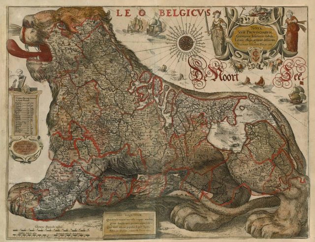
Leo by Visscher, 1650
Several later maps of the Dutch Republic also show the Latin title Belgium Foederatum. Also, a colonial province from the 17th century, that was located on the East Coast of North America and ruled and settled exclusively by the Dutch Republic in which the present Belgium had no share, was known as Nieuw-Nederland in Dutch or as Nova Belgica or Novum Belgium in Latin.
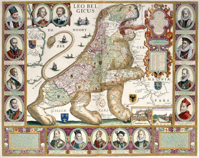
Leo Belgicus by Aitsinger and Hogenberg, 1583
The first Leo Belgicus was drawn in 1583 by the Austrian cartographer baron Michael Aitzinger who was probably inspired by the prevalence of lions in the coats of arms of many of the Seventeen Provinces including Brabant, Flanders, Frisia, Guelders, Hainout, Limburg, Luxembourg, and Zeeland as well as those of William of Orange.
This was the period when the Dutch were fighting the Eighty Years War for independence.
Leo Belgicus by Jodocus Hondius, 1611
Leo Belgicus by Hondius & Gerritsz, 1630
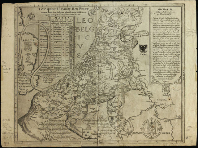
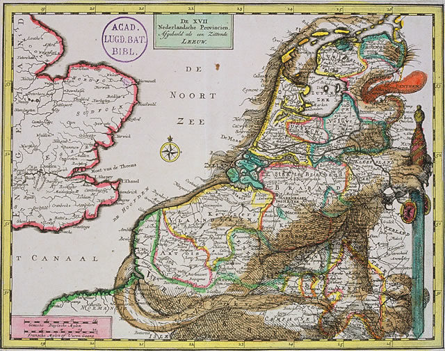
There were three different designs of the map and in the most common one, the lions head was located in the northernmost part of the country and the tail in the southeast.
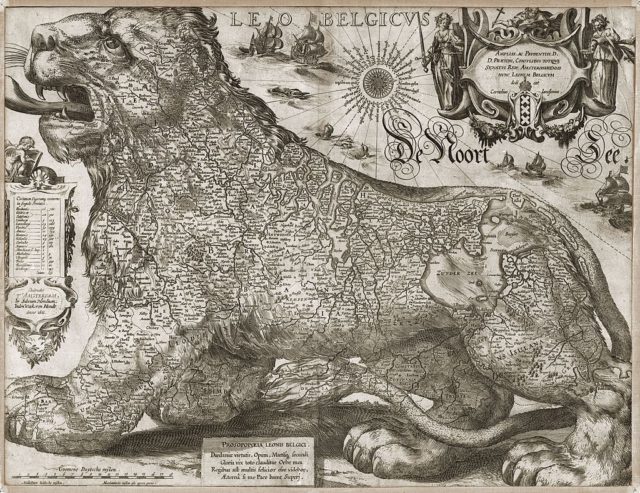
The most famous version of the map was published in 1609 on the occasion of the Twelve Years Truce by the Dutch engraver and mapmaker Claes Janszoon Visscher.
It spoke of strength and pride and echoed the presence of the lion in the heraldry of many Dutch towns. There is a reversed position of the lion in a less common design, as shown in the Leo Belgicus by Jodocus Hondius.
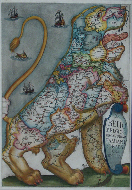
Bello Belgico by Stradæ, 1631
Leo by Schenk, 1707
In 1648, at the Peace of Westphalia seven provinces in the North had become an independent protestant republic and the South remained catholic and royal so the lion was cut in half.
Read another story from us: The Hereford Mappa Mundi is the worlds largest existing medieval map
It is called the Leo Hollandicus, the Holland Lion, and shows only the province of Holland. One of the earliest versions was published by Visscher around 1625.
There are currently 1 users browsing this thread. (0 members and 1 guests)
 Posting Permissions

 Reply With Quote
Bookmarks