


1


| Thumbs Up |
| Received: 34,729 Given: 61,129 |
Wake up and smell the coffee.
| Thumbs Up |
| Received: 34,729 Given: 61,129 |
Google Maps Route: https://goo.gl/maps/wS2NdiVqW4F2 A narrated walk down Fifth Avenue from the 5th Avenue - 59th Street Station to 23rd Street, where the Flatiron Building is located. Filmed January 8, 2019 Timestamps 1:45 - Someone bumps into me 2:31 - 60th Street 3:30 - 59th Street (Apple Store) 4:38 - 58th Street 5:55 - 57th Street (Trump Tower) 7:40 - 56th Street 8:50 - 55th Street 10:36 - 54th Street (Aggressive Cyclist and Woman nearly gets hit by a taxi) 12:05 - 53rd Street (UNIQLO) 13:22 - 52nd Street 14:22 - 51st Street (Saint Patrick's Cathedral [Actually Neo-Gothic Architecture], Atlas Statue & Rockefeller Center) 15:50 - 50th Street (Rockefeller Center Promenade & Sak's Fifth Avenue) 16:58 - 49th Street 18:25 - 48th Street (A fan says hello) 20:25 - 47th Street (Diamond District & More poor jaywalking) 21:35 - 46th Street (Little Brazil) 22:35 - 45th Street 23:40 - 44th Street 24:55 - 43rd Street (Poor jaywalking) 26:15 - 42nd Street (New York Public Library Main Branch) 27:36 - 41st Street 28:25 - 40th Street 29:50 - 39th Street 31:30 - 38th Street 33:00 - 37th Street 34:30 - 36th Street 36:00 - 35th Street (More poor jaywalking) 36:40 - Two people bump into each other 37:17 - 34th Street (Empire State Building) 38:55 - 33rd Street (Cyclist fails to yield to pedestrians) 40:00 - 32nd Street (Koreatown) 41:11 - 31st Street 42:20 - 30th Street 43:30 - 29th Street 44:25 - 28th Street 45:50 - 27th Street 47:30 - 26th Street 49:08 - 25th Street 50:20 - 24th Street 51:15 - 23rd Street (Flatiron Building - Completed in 1902)
Google Maps Route: https://goo.gl/maps/sKEkLeqBfcD2 A narrated walk through New York's Civic Center, walking through streets such as Centre Street, Broadway, Chambers Street, Duane Street, Worth Street, and Foley Square. From Wikipedia: "The Civic Center is the area of lower Manhattan, New York City, that encompasses New York City Hall, One Police Plaza, the courthouses in Foley Square, and the surrounding area. The district is bound on the west by Tribeca at Broadway, on the north by Chinatown at Worth Street or Bayard Street, on the east by the East River and the Brooklyn Bridge at South Street, and on the south by the Financial District at Ann Street." "Although government-related activities are predominant, other pursuits also occur within the district, including entertainment, industrial activity, residential dwellings, and warehousing. For example, there are Chinese restaurants near Civic Center's border with Chinatown, in addition to some museums and some residential buildings in the Civic Center area. The area is roughly 10 blocks long and 5 blocks wide, but is far less dense than most of Manhattan, where the average number of residents for an area that size is 35,000; the Civic Center has approximately 20,000 residents. The Jacob K. Javits Federal Building is located in the area. It includes the Federal Bureau of Investigation New York field office. Non-government buildings include the 387 feet (118 m) 15 Park Row, an office and residential building which was the city's highest from 1899 to 1908. 150 Nassau Street, a 21-story granite building, was once a publisher's building, as were many in the area, but is now a residential building, as is 38 Park Row. The 76-story 8 Spruce Street is among the world's tallest residential buildings. Southbridge Towers, once Mitchell-Lama affordable housing, is now market-rate housing." Filmed April 1, 2019 Timestamps 1:55 - Exiting the Chambers Street / Brooklyn Bridge-City Hall Subway Station 3:55 - Chambers Street & Centre Street 6:45 - Former Tweed Courthouse 9:02 - Broadway & Chambers Street 9:50 - Broadway & Warren Street (North Side of City Hall Park Entrance) 15:25 - South Side Entrance of City Hall Park at Park Row 18:55 - Broadway & Park Row 19:22 - Woolworth Building 21:38 - Broadway & Steve Flanders Square (New York City Hall Entrance) 24:45 - Broadway & Reade Street 26:11 - Broadway & Duane Street 27:25 - African Burial Ground 19:20 - Lafayette Street & Duane Street (Foley Square) 31:45 - Centre Street & Worth Street 33:25 - Centre Street & Pearl Street 37:40 - One Police Plaza (NYC Police Department Headquarters)
Wake up and smell the coffee.
| Thumbs Up |
| Received: 34,729 Given: 61,129 |
A narrated walk in NYC in the neighborhoods of Downtown Brooklyn, Brooklyn Heights, Brooklyn Bridge Park, and DUMBO. Wikipedia Links for More Information: https://en.wikipedia.org/wiki/Downtow... https://en.wikipedia.org/wiki/New_Yor... https://en.wikipedia.org/wiki/Brookly... https://en.wikipedia.org/wiki/Dumbo,_... https://en.wikipedia.org/wiki/Brookly... Timestamps 1:15 - Exiting Jay Street-MetroTech Subway Station 5:15 - Jay Street & Myrtle Avenue 9:40 - Tillary Street & Jay Street 15:40 - Cadman Plaza West & Tillary Street 22:00 - Joralemon Street & Court Street 25:00 - Joralemon Street & Clinton Street 29:26 - Joralemon Street & Hicks Street 33:15 - Joralemon Street & Furman Street (Brooklyn-Queens Expressway) 38:15 - Remsen Street & Hicks Street 39:55 - Montague Terrace & Remsen Street 41:35 - Brooklyn Heights Promenade Entrance at Remsen Street 44:05 - George Washington "Four Chimneys" Artifact 46:35 - Columbia Heights & Pierrepont Street 49:35 - Brooklyn Heights Promenade Entrance at Clark Street 54:45 - Brooklyn Bridge Park Entrance at Middagh Street (Closed for Renovations) 58:40 - Old Fulton Street & Furman Street (Brooklyn Bridge Park Fulton Ferry District) 1:03:25 - Brooklyn Bridge Park Entrance at Water Street and New Dock Street (St. Ann's Warehouse) 1:05:20 - Jane's Carousel 1:09:00 - Brooklyn Bridge Park Pebble Beach 1:11:00 - Walking Under the Manhattan Bridge 1:13:05 - Adams Street & John Street 1:15:00 - Brooklyn Bridge Park Entrance at Washington Street & Water Street 1:18:05 - Washington Street & Front Street 1:20:15 - Jay Street & Washington Street
A narrated walk down Manhattan's Broadway from Times Square at 49th Street to 14th Street - Union Square. Broadway in Manhattan is one of the most popular streets in the whole world, featuring memorable sites such as Times Square, Union Square Park, the Flatiron Building, and Wall Street. I talk about everything from New Year's Eve preparations in Times Square, people asking for donations, retail stores, history facts, NYC tips and tricks, and locations of famous landmarks.
Timestamps 1:13 - Exiting 49th Street (N)(R)(W) Subway Station 2:38 - 7th Avenue & 48th Street 3:34 - 7th Avenue & 47th Street 5:50 - 46th Street 7:10 - 45th Street 11:28 - 42nd Street 14:48 - 39th Street 17:00 - 37th Street 19:25 - 35th Street 20:54 - 34th Street 24:40 - 32nd Street 27:47 - 30th Street 31:00 - 27th Street 32:56 - 25th Street 36:00 - 23rd Street 38:50 - 21st Street 40:55 - 19th Street 43:05 - 17th Street
Wake up and smell the coffee.
| Thumbs Up |
| Received: 34,729 Given: 61,129 |
A narrated walking video in NYC along the entirety of the High Line Elevated Park from 34th Street to Gansevoort Street. Correction: At 39:00, the hotel is the Standard, not the Strand. From Wikipedia: "The High Line (also known as High Line Park) is a 1.45-mile-long (2.33 km) elevated linear park, greenway and rail trail. It was created on a former New York Central Railroad spur on the west side of Manhattan in New York City. Led by landscape architecture firm James Corner Field Operations, the abandoned railway has been redesigned as a "living system" that draws from multiple disciplines including landscape architecture, urban design, and ecology. Since opening in 2009, the High Line has become an icon in contemporary landscape architecture. The park is built on the disused southern viaduct section of a New York Central Railroad line called the West Side Line. Originating in the Lower West Side of Manhattan, the park runs from Gansevoort Street – three blocks below 14th Street – in the Meatpacking District, through Chelsea, to the northern edge of the West Side Yard on 34th Street near the Javits Center. Formerly, the West Side Line went as far south as a railroad terminal at Spring Street, just north of Canal Street. However, most of the southern section was demolished in 1960, with another small portion being demolished in 1991." Filmed February 27, 2019 Timestamps 0:50 - 34th Street - Hudson Yards Long Escalator 2:06 - Exiting 34th Street - Hudson Yards Subway Station 5:08 - 34th Street & 11th Avenue 7:17 - High Line Elevated Park Entrance 18:23 - 30th Street & 10th Avenue Entrance 20:25 - 28th Street Entrance 22:40 - 26th Street Entrance 25:20 - 23rd Street Entrance 29:20 - 20th Street Entrance 32:45 - High Line Observation Deck (Tenth Avenue Square) 34:40 - 16th Street Entrance 37:10 - 14th Street Entrance 41:30 - Gansevoort Street Entrance
Google Maps Route: https://goo.gl/maps/9dMwW2kdY192 A narrated walk in Midtown Manhattan along 34th Street in its entirety from the East River to the Hudson River. From Wikipedia: "34th Street is a major crosstown street in the New York City borough of Manhattan. It runs the width of Manhattan Island from West Side Highway on the West Side to the FDR Drive on the East Side. 34th Street is used as a crosstown artery between New Jersey to the west and Queens to the east, connecting the Lincoln Tunnel to New Jersey with the Queens Midtown Tunnel to Long Island. Several notable buildings are located directly along 34th Street, including the Empire State Building, Macy's Herald Square, and Javits Center. Other structures, such as Pennsylvania Station, are located within one block of 34th Street. The street hosts the crosstown M34/M34A bus routes and contains several subway stops. The street was designated by the Commissioners' Plan of 1811 that established the Manhattan street grid as one of 15 east-west streets that would be 100 feet (30 m) in width (while other streets were designated as 60 feet (18 m) in width). In April 2010, the New York City Department of Transportation proposed to add bus rapid transit along the 34th Street corridor. To create exclusive lanes for buses, the street would be converted to one-way westbound operation west of Sixth Avenue and one-way eastbound operation east of Fifth Avenue; a pedestrian plaza would be created between Fifth and Sixth avenues. The street was eventually kept in two-way operation." Filmed March 18, 2019 Timestamps 1:05 - NYC Ferry East River Ferry Landing 5:12 - FDR Drive 7:35 - 1st Avenue 9:50 - Tunnel Exit Street 10:30 - 2nd Avenue 13:25 - 3rd Avenue 15:37 - Lexington Avenue 18:09 - Park Avenue 20:10 - Madison Avenue 22:40 - 5th Avenue 27:25 - 6th Avenue / Broadway 31:43 - 7th Avenue 35:10 - 8th Avenue 37:33 - I drop my phone and someone returns it to me 38:30 - 9th Avenue 41:01 - Dyer Avenue 42:52 - 10th Avenue 47:05 - 11th Avenue 49:30 - High Line Elevated Park Entrance 51:20 - 12th Avenue
Wake up and smell the coffee.
| Thumbs Up |
| Received: 34,729 Given: 61,129 |
Google Maps Route: https://goo.gl/maps/hrfzr2ZXx6y A narrated walk along the busy 42nd Street in Manhattan. On the route I pass several places of interest, including Grand Central Terminal, the Port Authority Bus Terminal, Times Square, Bryant Park, and 5th Avenue. Filmed February 14, 2019 Timestamps 3:10 - Exiting Grand Central Terminal 3:53 - Park Avenue 4:53 - Vanderbilt Avenue 6:14 - Madison Avenue 9:05 - 5th Avenue 13:15 - 6th Avenue 16:37 - Broadway 17:48 - 7th Avenue 21:30 - 8th Avenue 25:30 - 9th Avenue 27:00 - Dyer Avenue 29:10 - 10th Avenue 32:52 - 11th Avenue 36:59 - 12th Avenue
Wake up and smell the coffee.


| Thumbs Up |
| Received: 24,200 Given: 15,976 |
Views from the Lincoln Zoo in Chicago.


| Thumbs Up |
| Received: 6,121 Given: 1,884 |
POUR UNE HISTOIRE DÉBARRASSÉE DES NOMBREUX MENSONGES
Vincent Reynouard: Je suis ingénieur chimiste et historien révisionniste français. Jexpose de la façon la plus pédagogique possible les arguments révisionnistes. Je propose, jexpose, je nimpose rien. Chacun doit (ou devrait) être libre de se faire une opinion sur le sujet. .


| Thumbs Up |
| Received: 2,779 Given: 208 |
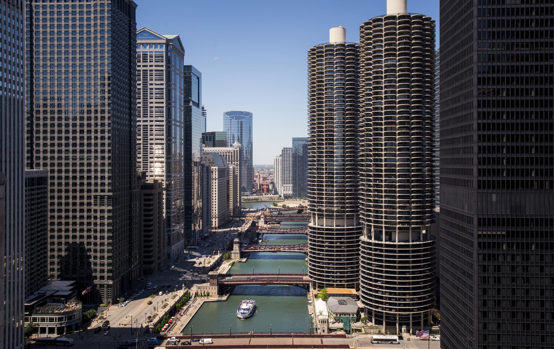
Chicago

| Thumbs Up |
| Received: 34,729 Given: 61,129 |
Google Maps Route: https://goo.gl/maps/y3j3Cuvb6KpBB6rW6 I walk in NYC through Riverside South, also known as Trump Place. This area used to be abandoned rail yards, but was bought up by Donald Trump and developed into an entire community. From Wikipedia: "Riverside South is an urban development project in the Lincoln Square neighborhood of the Upper West Side of Manhattan, New York City. It was originated by six civic associations The Municipal Art Society, Natural Resources Defense Council, The Parks Council, Regional Plan Association, Riverside Park Fund, and Westpride in partnership with real estate developer Donald Trump. The largely residential complex, located on the site of a former New York Central Railroad yard, includes Trump Place and Riverside Center. The $3 billion project is on 57 acres (23 ha) of land along the Hudson River between 59th Street and 72nd Street. Development of the rail yard site generated considerable community opposition. Trump's 1970s-era proposal was widely opposed and failed to gain traction. In 1982, Lincoln West, a much smaller project, was approved with community support, but the developers failed to obtain financing. Planning for the current project began in the late 1980s. The project was originally designed to include 16 apartment buildings with a maximum of 5,700 residential units, 1,800,000 square feet (170,000 m2) of studio space, 300,000 square feet (30,000 m2) of office space, ancillary retail space, and a 25-acre (10 ha) waterfront park. Trump sold Riverside South to investors from Hong Kong and mainland China, who began construction in 1997. In 2005, the investors sold the remaining unfinished portions to the Carlyle Group and the Extell Development Company." Filmed April 23, 2019 Timestamps 1:45 - Freedom Place South & 60th Street 2:51 - Freedom Place South & 61st Street 4:07 - Freedom Place South & 62nd Street 5:25 - 63rd Street & Freedom Place South 7:00 - Riverside Boulevard & 63rd Street 8:15 - Riverside Boulevard & 64th Street 9:20 - Riverside Boulevard & 65th Street 10:25 - Riverside Boulevard & 66th Street 11:25 - Riverside Boulevard & 67th Street 12:35 - Riverside Boulevard & 68th Street 13:36 - Riverside Boulevard & 69th Street 14:55 - Riverside Boulevard & 70th Street 16:05 - Riverside Boulevard & 71st Street 16:45 - 72nd Street & Riverside Boulevard
Wake up and smell the coffee.


| Thumbs Up |
| Received: 17,134 Given: 9,065 |
#MAGA
There are currently 1 users browsing this thread. (0 members and 1 guests)
 United States
 Christianity
United States
United States
Christianity
United States
United States
 Posting Permissions


 Reply With Quote


Bookmarks