


1


| Thumbs Up |
| Received: 20,923 Given: 18,998 |
Map: https://upload.wikimedia.org/wikiped...e_Spis1910.png
Map of Polish-speaking population in 1910:
https://commons.wikimedia.org/wiki/F...olacy_1910.png
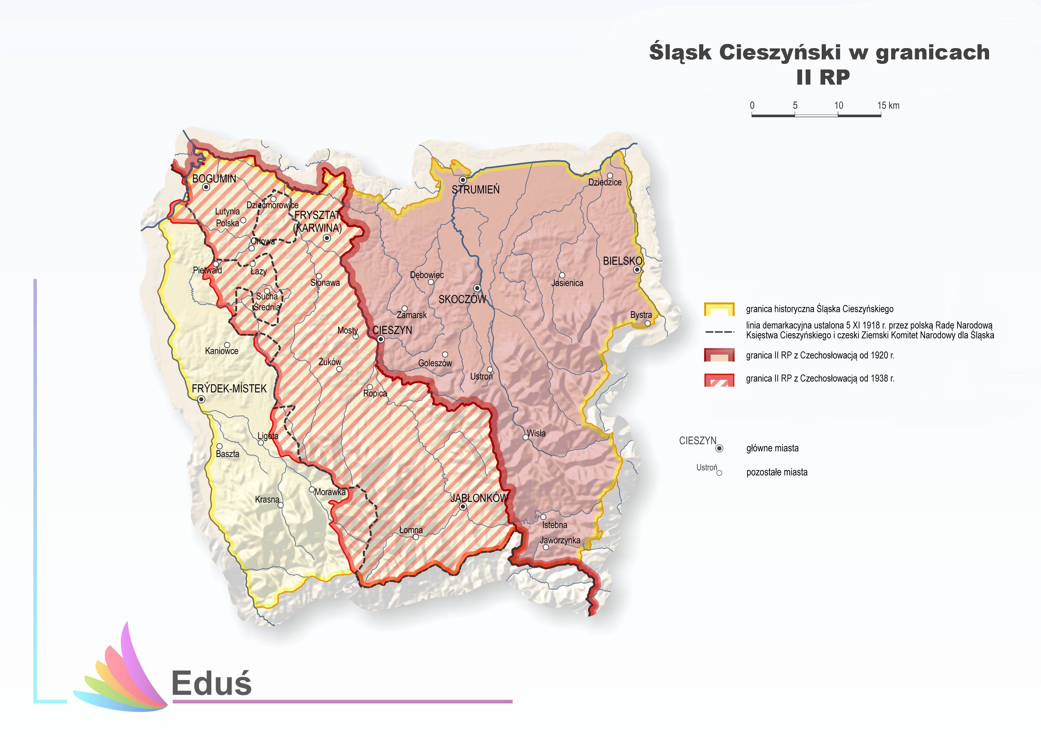
^^^ Superimposed on the map showing:
Yellow line - border of the Duchy of Cieszyn in the 1500s
Blue line - state border from the 5th of November 1918
Red line - state border from the 10th of December 1938
Political borders: http://edus.ibrbs.pl/wp-content/uplo...12-korekta.jpg
=====
Compare also with the map of languages of Austria in 1910:
http://i.imgur.com/AQKwaCL.jpg
https://www.reddit.com/r/MapPorn/com...910_2785x2197/
There are currently 1 users browsing this thread. (0 members and 1 guests)
 Česká republika
 Polska
 România
 Posting Permissions


 Reply With Quote
Bookmarks