


0


| Thumbs Up |
| Received: 19,497 Given: 36,945 |
Bolivar state in southern Venezuela is the biggest Venezuelan state, but is also very underpopulated. Most of its population lives in some few cities and towns mostly concentrated in the North eastern corner of the state, in the margins of the Orinoco River (like Ciudad Bolivar or Ciudad Guayana) or not far from it. Most of the rest of the state is vast, mostly unpopulated, including parts occupied by tropical rainforests, as well as more temperate highlands that constitute the "Escudo Guayanes" including the national park "Canaima" in the south eastern corner of the state, very close to the border with Brazil.
Location within Venezuela of Bolivar state:
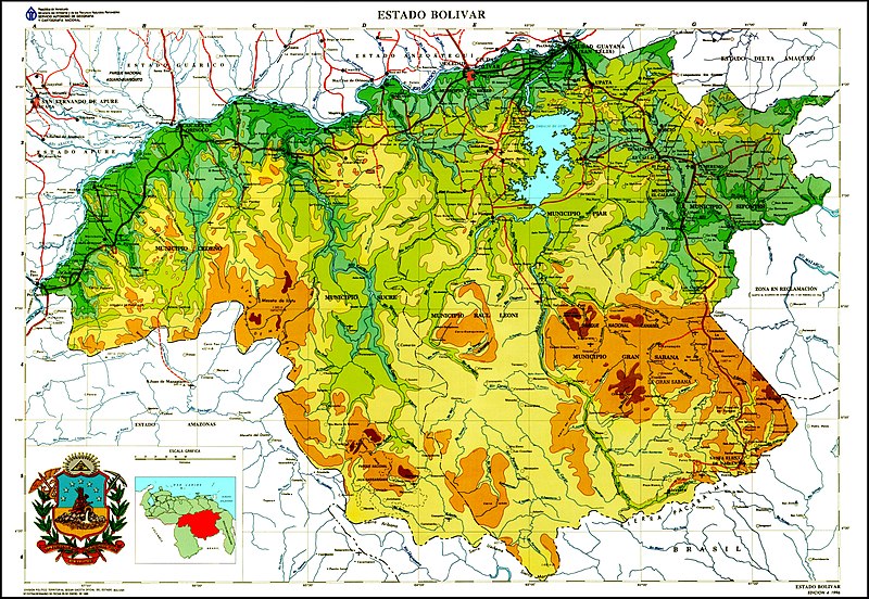
Map with the relief of Bolivar state:
Location of Ciudad Bolivar (Bolivar city), the state capital:
Gente de Ciudad Bolivar (People from Ciudad Bolivar, the capital of Bolivar state, Venezuela):
Last edited by alnortedelsur; 01-15-2021 at 05:09 PM.
My Updated 23andme Results (2021)
My Updated AncestryDNA Results (2022)
My Global25 Coordinates (2020)
An Epic Thread about me opened by Profield
Originally Posted by Profileid

| Thumbs Up |
| Received: 19,497 Given: 36,945 |
More people from Ciudad Bolivar (Bolivar city) the state capital:
My Updated 23andme Results (2021)
My Updated AncestryDNA Results (2022)
My Global25 Coordinates (2020)
An Epic Thread about me opened by Profield
| Thumbs Up |
| Received: 19,497 Given: 36,945 |
More Venezuelans from Bolivar city, Bolivar:
My Updated 23andme Results (2021)
My Updated AncestryDNA Results (2022)
My Global25 Coordinates (2020)
An Epic Thread about me opened by Profield
| Thumbs Up |
| Received: 19,497 Given: 36,945 |
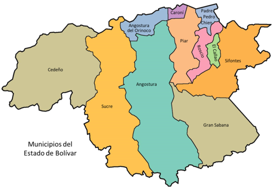
Almost forgot. Map of the municipalities of Bolivar state, so that you can get an idea of the exact location of pics and videos:

My Updated 23andme Results (2021)
My Updated AncestryDNA Results (2022)
My Global25 Coordinates (2020)
An Epic Thread about me opened by Profield
| Thumbs Up |
| Received: 19,497 Given: 36,945 |
Kids, from the city of San Felix, which along with the city of Puerto Ordaz form the conurbation of Ciudad Guayana, in the municipality of Caroni (north of the state) and east from Bolivar city):
My Updated 23andme Results (2021)
My Updated AncestryDNA Results (2022)
My Global25 Coordinates (2020)
An Epic Thread about me opened by Profield
| Thumbs Up |
| Received: 19,497 Given: 36,945 |
Some people from San Felix, Bolivar:

My Updated 23andme Results (2021)
My Updated AncestryDNA Results (2022)
My Global25 Coordinates (2020)
An Epic Thread about me opened by Profield
| Thumbs Up |
| Received: 19,497 Given: 36,945 |
My Updated 23andme Results (2021)
My Updated AncestryDNA Results (2022)
My Global25 Coordinates (2020)
An Epic Thread about me opened by Profield
| Thumbs Up |
| Received: 19,497 Given: 36,945 |
High school students from Puerto Ordaz, Bolivar:
My Updated 23andme Results (2021)
My Updated AncestryDNA Results (2022)
My Global25 Coordinates (2020)
An Epic Thread about me opened by Profield
| Thumbs Up |
| Received: 19,497 Given: 36,945 |
Checking this thread after very long time, I see that all pics and videos have remained intact all this time, except the map of the Bolivar municipalities that got vanished. So, here we go again:
Another relief map of the state. As I said, all those mountains constitute the Guianas Massif, which is a series of mountains (with peaks of up to 3000 meters) and some high plains at an average altitudes of 900-1000 meters above sea level.
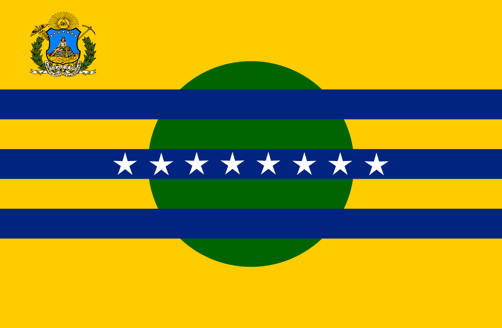
State Flag:
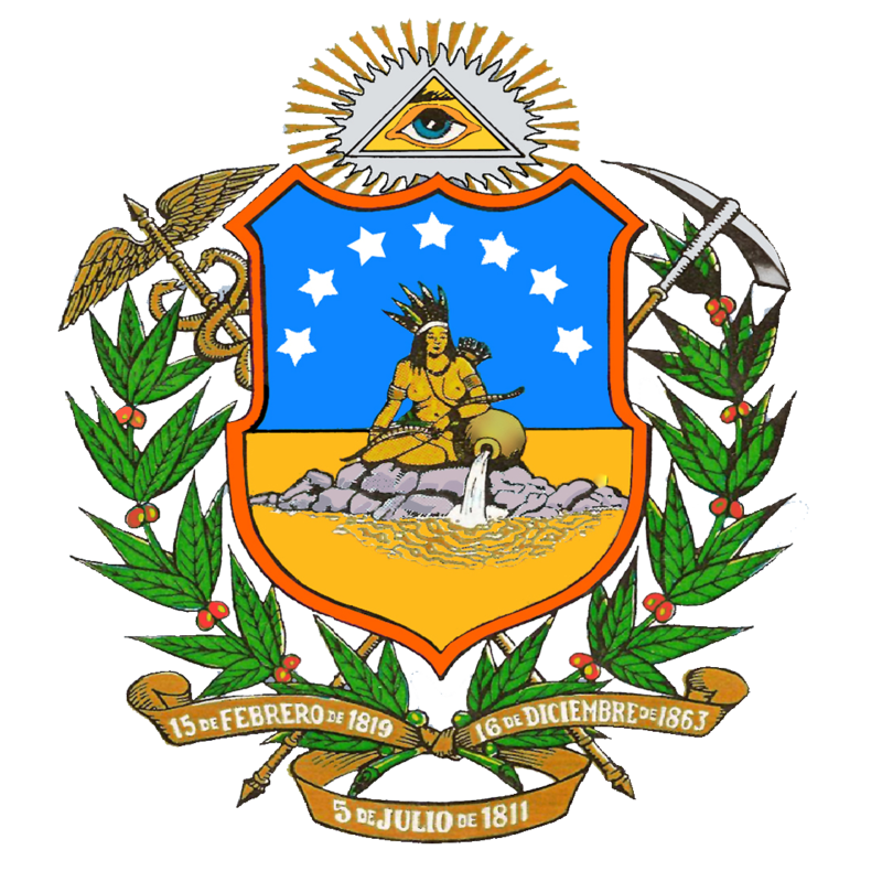
State Coat of Arms:
And following the tradition of these threads of mine, the state limits:
It limits to the north (with the Orinoco river marking its northern limit) with Delta Amacuro, Monagas, Anzoategui and Guarico, to the east with the Guiana Esequiva (a zone that is claimed by Venezuela to the neighbor country of Guyana), to the south with Brazil (state of Roraima), to the southwest with Amazonas state, and to the west with Apure.
Area: 242,801 km2 (93,746 sq mi)
Population: 1,720,000 (2020)
Thread bumped!
My Updated 23andme Results (2021)
My Updated AncestryDNA Results (2022)
My Global25 Coordinates (2020)
An Epic Thread about me opened by Profield
| Thumbs Up |
| Received: 19,497 Given: 36,945 |
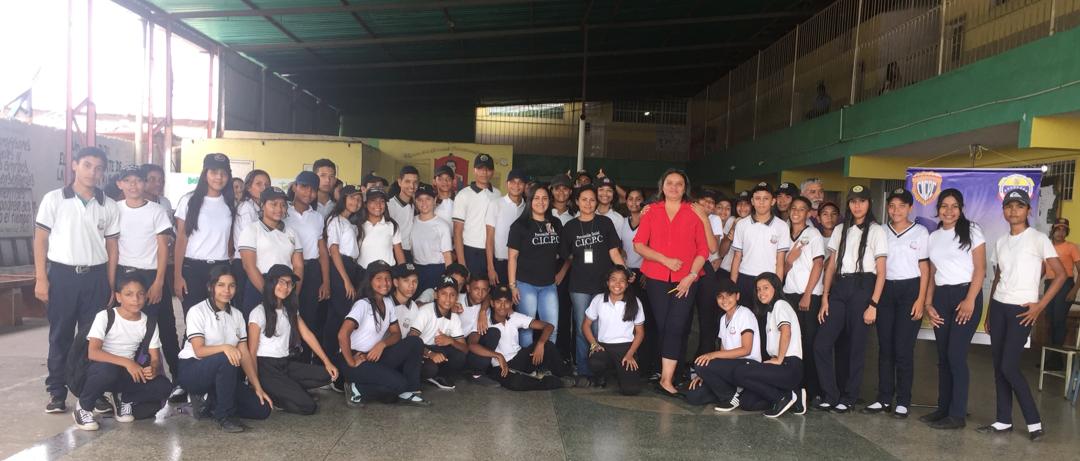
School students from Ciudad Bolivar, state capital, located in the municipality of Angostura del Orinoco (see map):
My Updated 23andme Results (2021)
My Updated AncestryDNA Results (2022)
My Global25 Coordinates (2020)
An Epic Thread about me opened by Profield
There are currently 1 users browsing this thread. (0 members and 1 guests)
 Latin America
Latin America
Latin America
Latin America
Latin America
Latin America
Latin America
Latin America
Latin America
 Posting Permissions


 Reply With Quote


Bookmarks