


0


| Thumbs Up |
| Received: 19,479 Given: 36,890 |
Similarly to Aragua state, the geography relief of Carabobo state consist of the same two mountain ranges (that come from Aragua), the coastal range in the north of the state (which merges into the Nirgua basin to the very west of Carabobo and southeastern Yaracuy (its neighbor state to the west)), the interior mountain range (Serrania del interior) to the south of the state, and a central depression, which in the case of Carabobo, is the Valencia Lake Basin, where Valencia, the Capital, is located. The average altitude of the Valencia lake basin is 400 meters above sea level (the altitude where the Valencia lake is located), but the city of Valencia, located few miles west from Valencia lake, is at about an average altitude of 520 meters (1710 feet) above the sea level.
Location of Carabobo state within the Venezuelan territory:
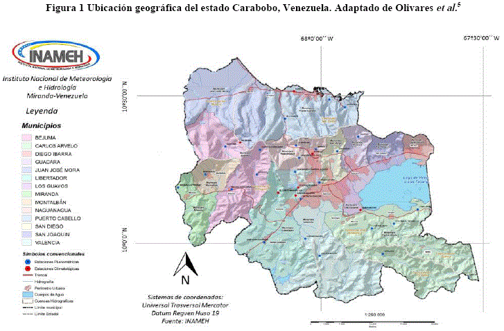
Map of the main population centers and municipalities of the state, for those who want to look up the location within the state of the pics and videos:
Relief of Carabobo state:
A couple of videos of the Valencia bus terminal:
My Updated 23andme Results (2021)
My Updated AncestryDNA Results (2022)
My Global25 Coordinates (2020)
An Epic Thread about me opened by Profield
Originally Posted by Profileid


| Thumbs Up |
| Received: 26,209 Given: 43,751 |
Not surprisingly, they are fairly similar to Coastal Colombians.
| Thumbs Up |
| Received: 19,479 Given: 36,890 |
In your opinion, what's your estimate of European, Amerindian and African in those two videos?
Also, which parts of coastal Colombia do they look like the most?
My Updated 23andme Results (2021)
My Updated AncestryDNA Results (2022)
My Global25 Coordinates (2020)
An Epic Thread about me opened by Profield
| Thumbs Up |
| Received: 19,479 Given: 36,890 |
In the social map of the city of Valencia, in the northern parts of the city predominate the middle/upper middle class neighborhoods, while in the southern parts of the city predominate the lower and working classes.
South of Valencia:
My Updated 23andme Results (2021)
My Updated AncestryDNA Results (2022)
My Global25 Coordinates (2020)
An Epic Thread about me opened by Profield
| Thumbs Up |
| Received: 19,479 Given: 36,890 |
Famosas Venezolanas nativas de este estado. Ambas son de Valencia, Carabobo:
Yvonne Reyes:
Actriz Coraima Torres:

My Updated 23andme Results (2021)
My Updated AncestryDNA Results (2022)
My Global25 Coordinates (2020)
An Epic Thread about me opened by Profield


| Thumbs Up |
| Received: 9,836 Given: 5,025 |
Mainly Mestizos.
| Thumbs Up |
| Received: 19,479 Given: 36,890 |
In which region of Brazil would they fit the best, in your opinion?
My Updated 23andme Results (2021)
My Updated AncestryDNA Results (2022)
My Global25 Coordinates (2020)
An Epic Thread about me opened by Profield
| Thumbs Up |
| Received: 9,836 Given: 5,025 |
I think more in the north, but they seem to have a diferent vibe.
| Thumbs Up |
| Received: 19,479 Given: 36,890 |
Valencia, Carabobo:
My Updated 23andme Results (2021)
My Updated AncestryDNA Results (2022)
My Global25 Coordinates (2020)
An Epic Thread about me opened by Profield
| Thumbs Up |
| Received: 19,479 Given: 36,890 |
-------------------------
My Updated 23andme Results (2021)
My Updated AncestryDNA Results (2022)
My Global25 Coordinates (2020)
An Epic Thread about me opened by Profield
There are currently 1 users browsing this thread. (0 members and 1 guests)
 Latin America
Latin America
Latin America
Latin America
Latin America
Latin America
Latin America
Latin America
Latin America
 Posting Permissions


 Reply With Quote

Bookmarks