


5


| Thumbs Up |
| Received: 19,500 Given: 36,948 |
With a surface area of 11,100 square kilometers, and a current population that nowadays must surpass 1,200,000 inhabitants, the Andean state of Tachira is located in the very southwestern corner of Venezuela. Is the last Venezuelan state that I'm covering with my series of threads about Venezuelan phenotypes.
This state borders Zulia State to the north, Barinas and Mérida States to the east, Apure and Barinas States to the south, and Colombia (Norte de Santander Department) to the west.
The state capital is San Cristobal (approaching 300,000 inhabitants, and located at an average altitude of 860 meters above sea level).
The geography of most of the state is dominated by the Andean range. Its highest peak is La Montaña el Pulpito, which about 3995 meters above the sea level, and it has several other high mounts with very high altitudes, many of them well over 3000 meters above sea level.
Like in the states of Trujillo and Merida, most of the state (except in the northern jungle-like lowlands bordering the state of Zulia, and the south eastern lowlands bordering the llanos from Barinas) has a mountain temperate climate. The capital San Cristobal, has very similar climate to Caracas, with an average temperature of 20.5 ° C, with averages of sunny hours of 26 ° C and 16 ° C for night hours (historical records in the single digits, but not frequent). However, in higher cities like Pregonero, El Cobre, La Grita and others located at higher altitudes, the average temperatures are considerably lower (up to 10 ° C) no to mention their freezing dew points.
Most of the state's urban centers are located in the region known as the mountain circuit, which is the areas of the state covered by the Andes, at altitudes between 800 and 3000 meters above sea level.
Location of Tachira state within the Venezuelan territory:
Map of the different municipalities of the state, for those of you interested in looking up the exact location of pics and videos:
Relief map of the state:
Panoramic of San Cristobal del Tachira, the state capital:
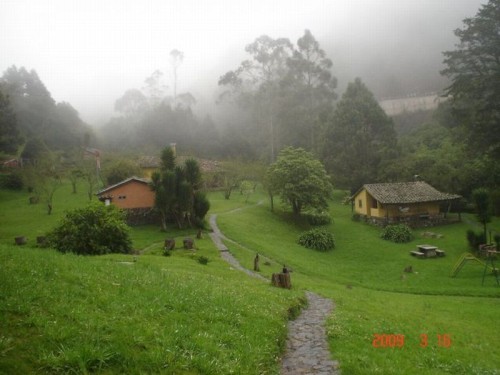
Some landscapes of this beautiful Andean state:
Video showing Tachira state and its people, including several places, starting with San Cristobal, and continuing with high towns and diverse places of the Tachirense geography. Is a little bit long, but worth to watch (at least jumping from part to part, if you don't wanna watch it all):
More pics and videos on next posts...
My Updated 23andme Results (2021)
My Updated AncestryDNA Results (2022)
My Global25 Coordinates (2020)
An Epic Thread about me opened by Profield
Originally Posted by Profileid


| Thumbs Up |
| Received: 325 Given: 235 |
beautiful pictures and video... it reminds me of El Salvador's countryside (my family is from the countryside) thats the best areas of Latin America in my opinion... most look mestizo of varying degree... i want to visit the mestizo side of Venezuela and Tachira seems like the perfect place
| Thumbs Up |
| Received: 19,500 Given: 36,948 |
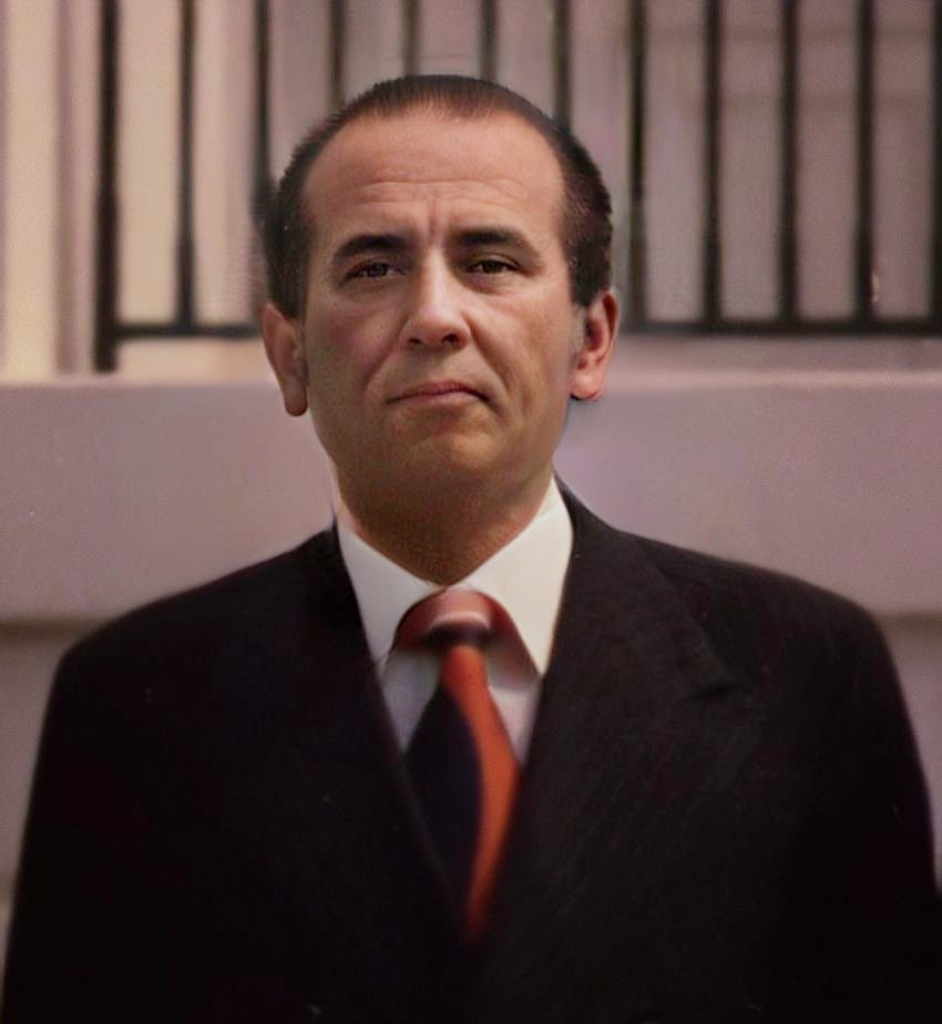
A series of Venezuelan ex-presidents that ruled Venezuela during the XIX and XX centuries were natives from Tachira state. Most of them presiding military regimes. Some of them (only during the XX century)...
Juan Vicente Goimez (In office from 1908-1935):
Eleazar Lopez Contreras (1935-1941):
Isaias Medina Angarita (1941-1945):
Marcos Perez Jimenez (1948-1958):
During the Democratic period...
Carlos Andres Perez (1974-1979) (1989-1993):
Last edited by alnortedelsur; 09-09-2021 at 06:45 AM.
My Updated 23andme Results (2021)
My Updated AncestryDNA Results (2022)
My Global25 Coordinates (2020)
An Epic Thread about me opened by Profield
| Thumbs Up |
| Received: 19,500 Given: 36,948 |
My Updated 23andme Results (2021)
My Updated AncestryDNA Results (2022)
My Global25 Coordinates (2020)
An Epic Thread about me opened by Profield
| Thumbs Up |
| Received: 19,500 Given: 36,948 |
Short videos with good resolution and lots of people from San Cristobal del Tachira, the state capital:
My Updated 23andme Results (2021)
My Updated AncestryDNA Results (2022)
My Global25 Coordinates (2020)
An Epic Thread about me opened by Profield
| Thumbs Up |
| Received: 19,500 Given: 36,948 |
Multitudes de Chavistas del estado Tachira:
My Updated 23andme Results (2021)
My Updated AncestryDNA Results (2022)
My Global25 Coordinates (2020)
An Epic Thread about me opened by Profield
| Thumbs Up |
| Received: 19,500 Given: 36,948 |
Public School from San Cristobal del Tachira, the state's capital:

My Updated 23andme Results (2021)
My Updated AncestryDNA Results (2022)
My Global25 Coordinates (2020)
An Epic Thread about me opened by Profield
| Thumbs Up |
| Received: 19,500 Given: 36,948 |
Continuing with same school from San Cristobal:

My Updated 23andme Results (2021)
My Updated AncestryDNA Results (2022)
My Global25 Coordinates (2020)
An Epic Thread about me opened by Profield
Beautiful landscapes.
I see more whites here than in other regions you have made threads about (the ones I have seen).
| Thumbs Up |
| Received: 19,500 Given: 36,948 |
Yeap! The Venezuelan Andean region (more so in the states of Merida and Tachira, and to a less extent in Trujillo state) is characterized for having a great percentage of people into the white/Euro mestizo range in their general population compared to the rest of the country. After all, the Venezuelan Andes are a prolongation of the Colombian Andes (Cordillera Oriental).
There are also many whites and Euro mestizos in large cities from other Venezuelan non-Andean regions (like in Caracas, Maracay, Valencia, etc), but they are more concentrated in middle/upper middle classes from those cities.
However, in the largest cities from the Andean states, like in Valera (Trujillo), Merida City (Merida), and San Cristobal (Tachira), there are also some triracials here and there, since those important urban centers have also attracted immigrants from other parts of Venezuela.
Those Andean cities, however, are still predominately mestizo/Euro-mestizo/white. Is just that they have also attracted Venezuelans from other regions, and today are not as exclusively mestizo/Euro mestizo/white as they were in the past.
My Updated 23andme Results (2021)
My Updated AncestryDNA Results (2022)
My Global25 Coordinates (2020)
An Epic Thread about me opened by Profield
There are currently 1 users browsing this thread. (0 members and 1 guests)
 Latin America
Latin America
Latin America
Latin America
Latin America
Latin America
Latin America
Latin America
Latin America
 Posting Permissions


 Reply With Quote
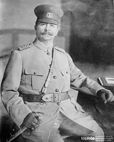


Bookmarks