


2


| Thumbs Up |
| Received: 19,483 Given: 36,918 |
I am remaking this thread, since the original thread of this state got screwed up when in some of my posts with school pictures, the pictures are now gone.
The state of Anzoátegui is an eastern Venezuelan state, which most of its interior belongs to the Venezuelan llanos (central plains of the country) but also has coasts in the Caribbean sea, where cities like Barcelona (state capital) and Puerto La Cruz (both cities are actually so close to each other that form a same conurbation) are located.
The state limits to the north with the Caribbean sea, to the northeast with Sucre state, to the east with Monagas, to the south with Bolivar (Orinoco river marking the limit) and to the west with Guarico and Miranda.
The state took its name after the independence leader Jose Antonio Anzoategui, who was born in Barcelona (Anzoategui's state capital).
Location of Anzoátegui state:
Map of the state municipalities, so those of you who want to know the exact location of pics and videos could look them up in this map:
The state is mostly plain, though it has some minor elevations (a weak prolongation of the Serrania del interior, coming from the west) in the very north close to the coasts, and a little bit of the eastern massif (macizo oriental) in the very north east of the state, bordering the state of Sucre (strong orange in the relief map). The light yellow colored area extending up to the middle of the state in the relief map (below) is the mesa of Guanipa, which is like a low altitude "meseta" with an average altitude of 272 meters above sea level. Relief map:

Last edited by alnortedelsur; 10-13-2021 at 12:03 AM.
My Updated 23andme Results (2021)
My Updated AncestryDNA Results (2022)
My Global25 Coordinates (2020)
An Epic Thread about me opened by Profield
Originally Posted by Profileid

| Thumbs Up |
| Received: 19,483 Given: 36,918 |
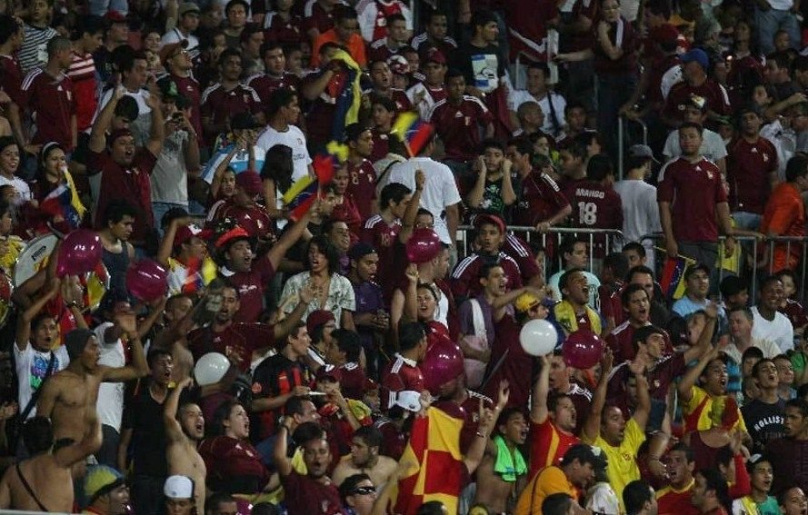
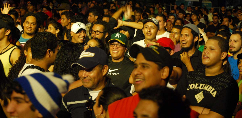
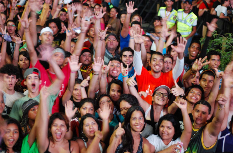
Football/soccer fans in the stadium "Jose Antonio Anzoategui" in Puerto La Cruz, Anzoategui:
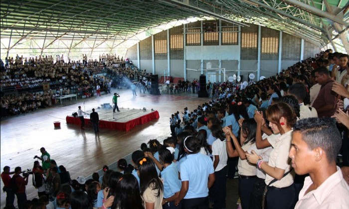
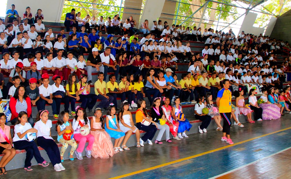
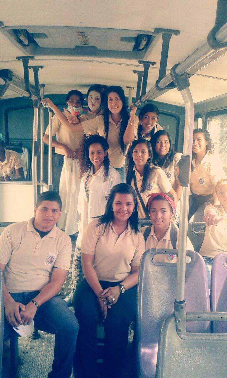
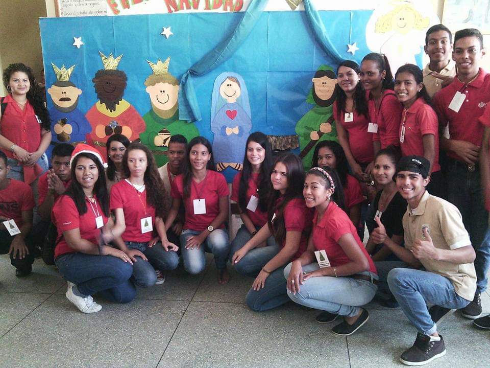
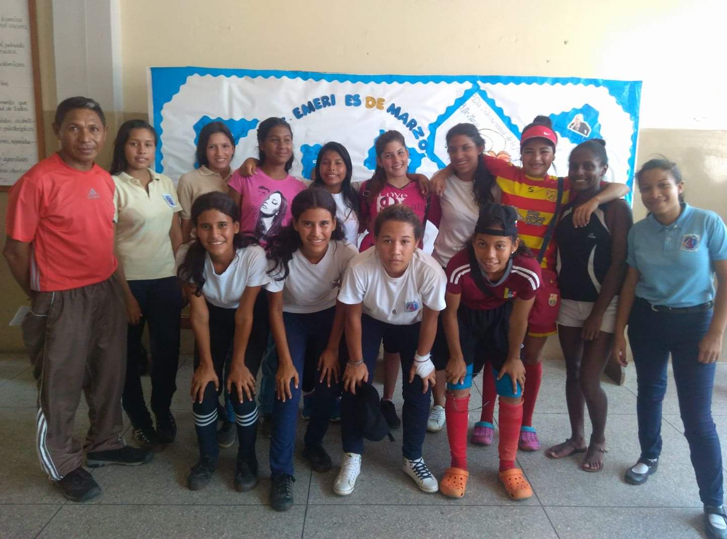
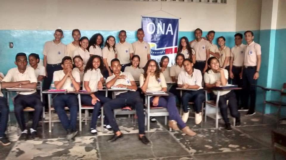
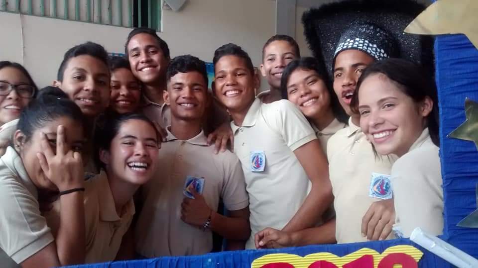
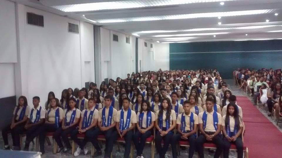
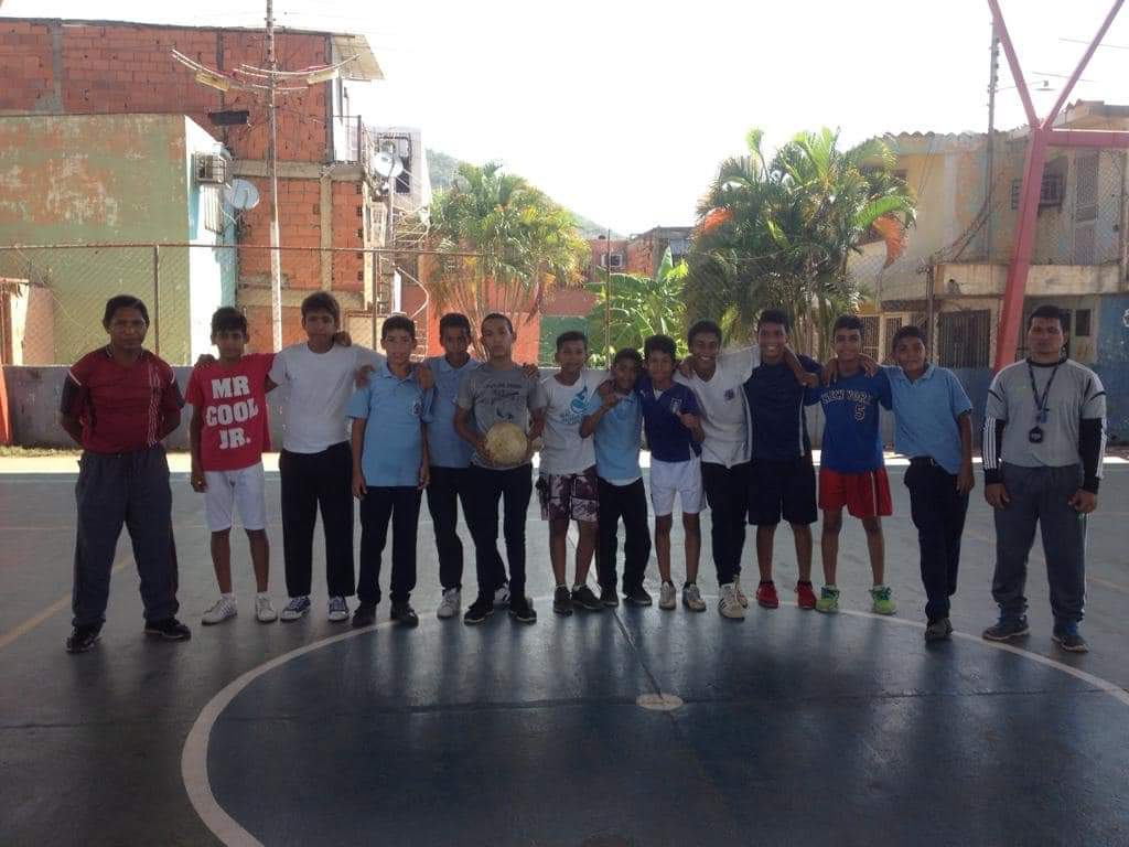
Schools students from Puerto La Cruz (coastal city of around 120,000 inhabitants), Anzoategui:
My Updated 23andme Results (2021)
My Updated AncestryDNA Results (2022)
My Global25 Coordinates (2020)
An Epic Thread about me opened by Profield

| Thumbs Up |
| Received: 2,586 Given: 0 |
Precisamente estuve viendo ayer el resumen del partido entre Venezuela y Ecuador, y habia una fuerte discrepancia fenotipica entre los jugadores de venezuela y la poca afición venezolana que fue a ver el partido. Los que fueron a ver el partido eran predominantemente europeos mientrás que los jugadores eran en su mayoría mulatos, pardos, trirraciales. Creo que ninguno de los grupos es lo más representativo de la población venezolana. Los primeros sería representantes de la reducida clase media, mientrás que los jugadores son representantes de lo más oscuro de la clase baja venezolana, con una sobrevaloración del aporte negroide como pasa en casi todas las actividades deportivas. Pero esto no es nada comparable con la selección de Ecuador que de 11 jugadores, conté 9 mulatos-negros. Yo si fuera ecuatoriano, no me sentiría representado por la está selección ecuatoriana, y me importaría una mierda que ganaran o perdieran. Incluso es probable que quisiera que perdieran.


| Thumbs Up |
| Received: 8,180 Given: 8,859 |
Lo de Ecuador si que es una tragedia.


| Thumbs Up |
| Received: 586 Given: 738 |
Lo de Ecuador es notable, no pasa en ningún otro país
.


| Thumbs Up |
| Received: 1,745 Given: 749 |
En el caso de Ecuador esto viene desde 1988, cuando el técnico montenegrino Dusan Drasković empezó a poner varios negros en el equipo porque, según él "los negros serían más atléticos" que el ecuatoriano promedio. Y desde entonces yo diría que Ecuador tuvo buenos resultados en el fútbol se clasificó para cuatro Mundiales (2002, 2006, 2010, 2014) algo inédito porque Ecuador nunca antes se había clasificado para un Mundial y los equipos ecuatorianos (también lleno de negros) lograron buenos resultados a nivel continental, ya ganaron una Copa Libertadores y dos Copa Sudamericanas (nuestra Champions y Europa League) y además, como tenías que saber Ecuador le va bien en la clasificatorios para el mundial de 2022, están solo detrás de Brasil y Argentina y probablemente se clasificaron para el Mundial de 2022.
Para ser honesto si Ecuador jugara con sus indo-mestizos no creo que hayan logrado este éxito en el fútbol, como mucho sería un equipo boliviano.
| Thumbs Up |
| Received: 2,586 Given: 0 |
Tienes razón en que solo jugando con indios de la sierra, Ecuador sería una mierda de selección. Pero los negros-mulatos son solo el 7,2% de la población y sin embargo son el 80% del equipo. Es demasiada desproporción. Estoy seguro que en Ecuador hay un 20-30% de mestizos con más de un 40% de componente europeo que serían validos para el fútbol. Colombia con una selección llena de negros no ha demostrada jamás ser superior a una Argentina con una selección llena de mestizos. Por tanto, seguro que si metes más mestizos en la selección, más algún indio que seguro que hay alguno con talento, te queda una selección mucho más representativa e igual de competitiva. La única selección llena de negros-mulatos que han tenido buenos resultados es Francia. Belgica ha amagado con hacer algo, pero al final nunca ha pasado de una semifinal ni la de la Liga de Naciones. Inglaterra y Países Bajos han llenado su selección de negros-mulatos pensando que se iban a comer el mundo, para después no ser superior a una Italia o incluso una España en el caso inglés, o directamente fracasar absolutamente como el caso neerlandes. En Ecuador estoy seguro que a la hora de seleccionar chavales para las categoría inferiores equipos de fútbol importantes, discriminan a los mestizos, blancos e indios frente a los negros y mulatos que son priorizados porque son mas fuertes fisicamente, cuando en realidad la superioridad fisica que tienen los negros-mulatos a edades tempranas, se diluye en gran medida cuando llegan a edad adulta.
| Thumbs Up |
| Received: 19,483 Given: 36,918 |
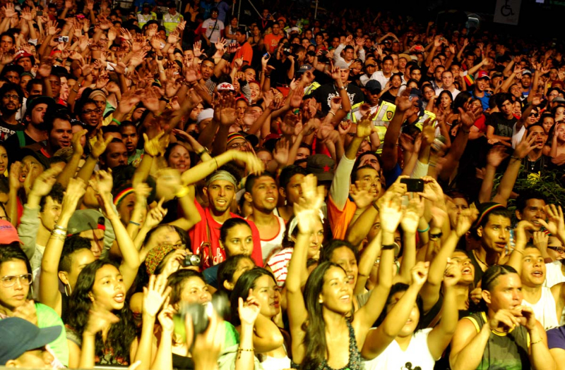
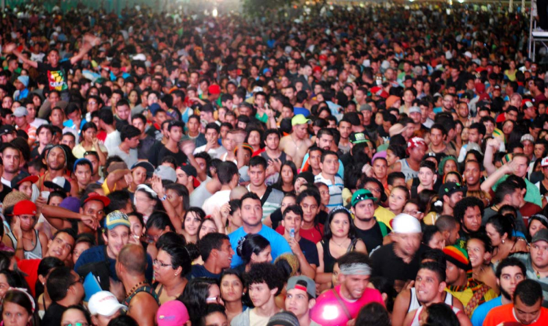
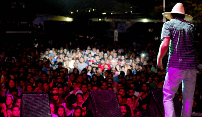
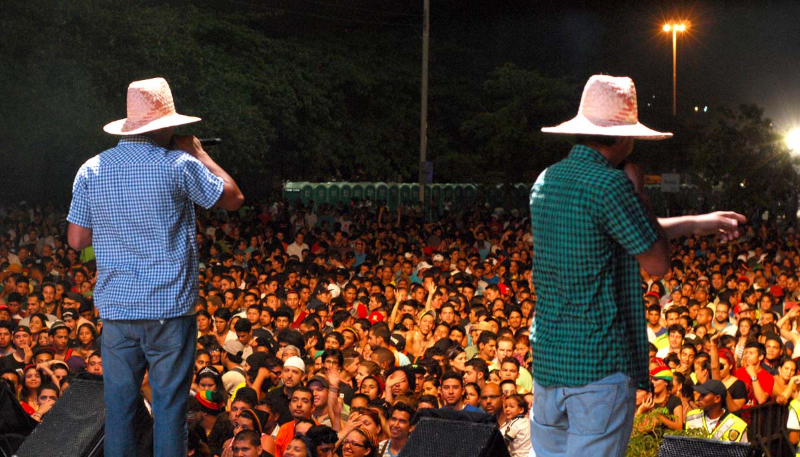
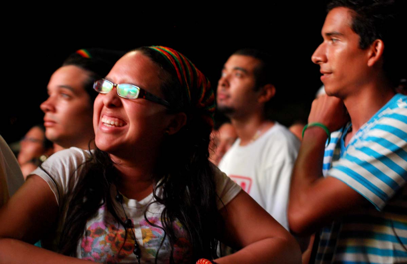
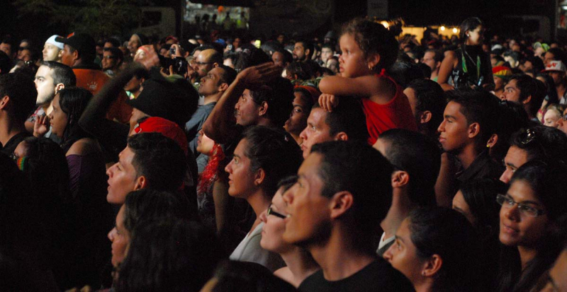
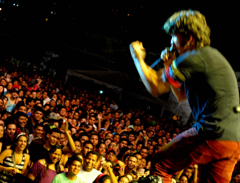
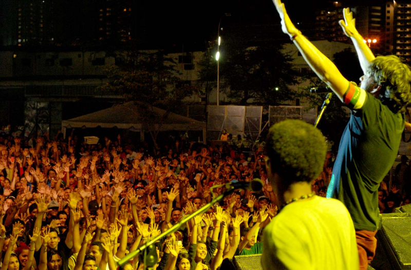
Concert in Puerto La Cruz, Anzoategui:
My Updated 23andme Results (2021)
My Updated AncestryDNA Results (2022)
My Global25 Coordinates (2020)
An Epic Thread about me opened by Profield


| Thumbs Up |
| Received: 3,395 Given: 890 |
Hasta no hace mucho tiempo la selección venezolana era un microcosmos de los emigrantes españoles-portugueses-italianos-otros de mediados del siglo XX.
Lo mismo pasaba en Australia o Canadá. Y a juzgar por los nombres de los equipos en primera división que perduran hoy día (paradójicamente en todos los países mencionados los equipos étnicos fueron desapareciendo), sucedió en algún momento en Chile, y también en México (aunque aquí prohibieron los equipos étnicos de inmigrantes rápidamente)
| Thumbs Up |
| Received: 19,483 Given: 36,918 |
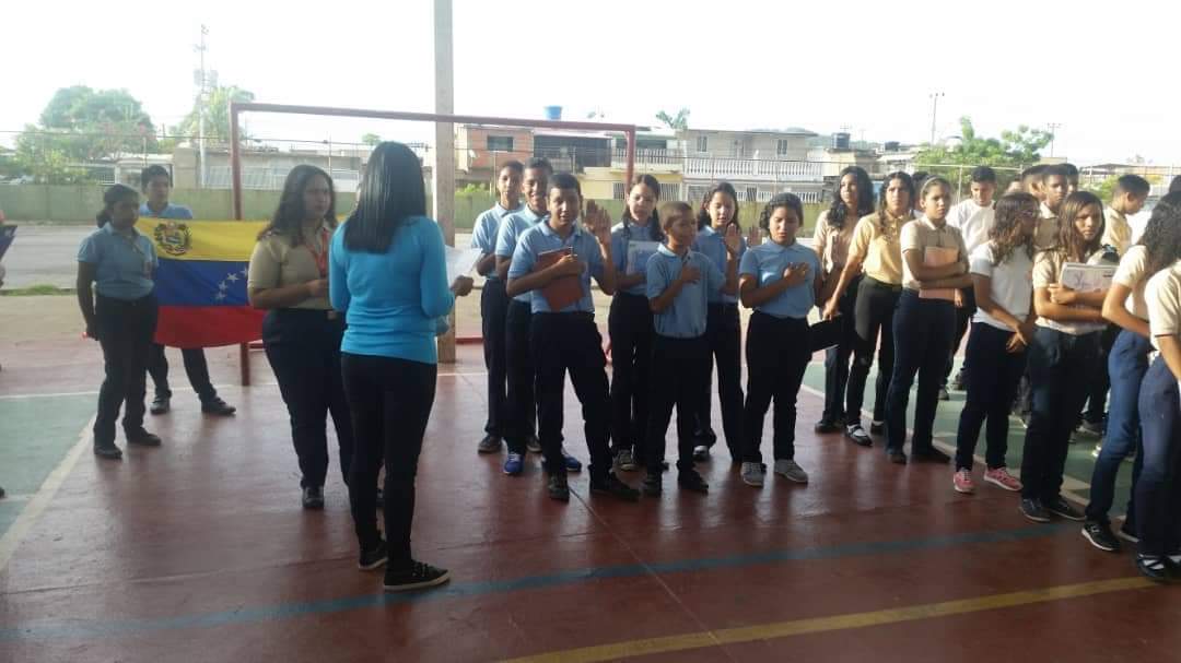
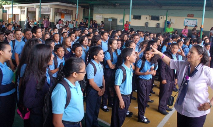
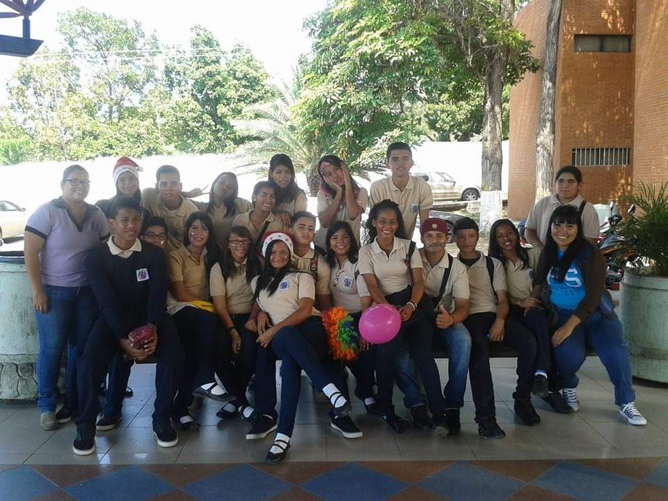
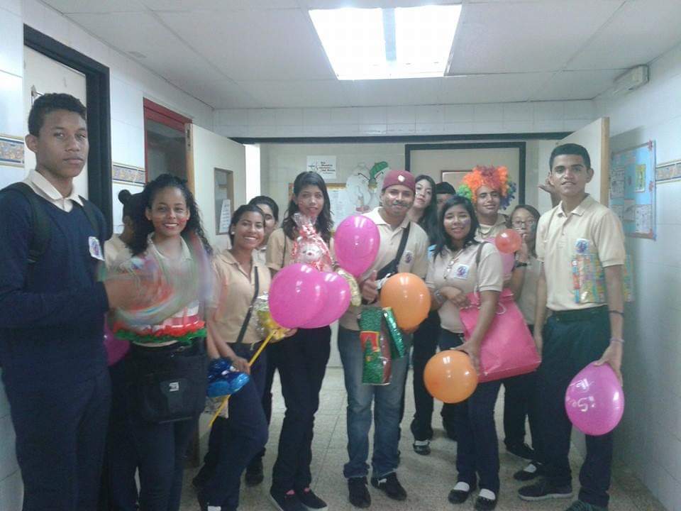
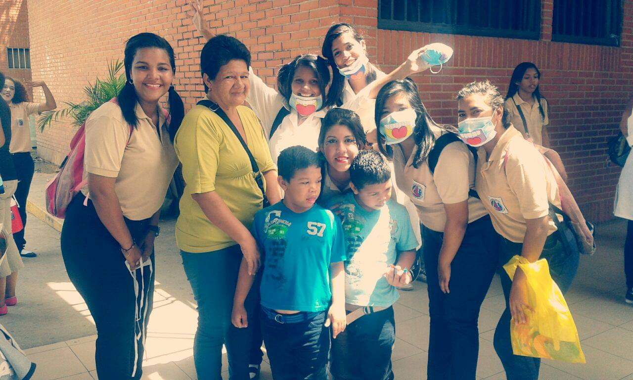
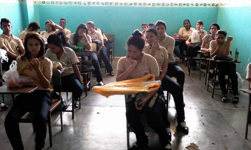
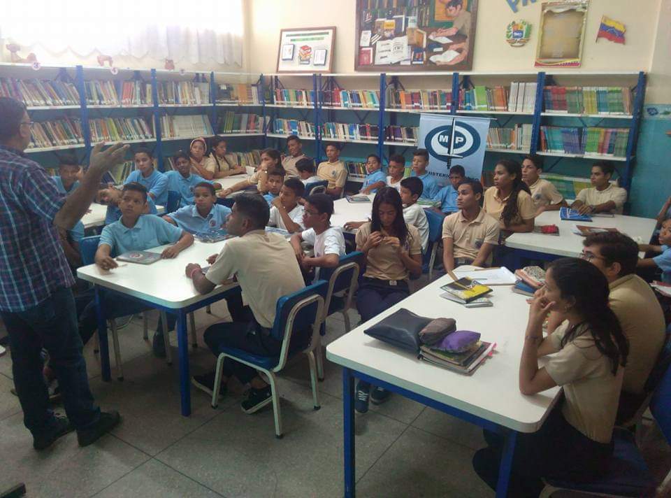
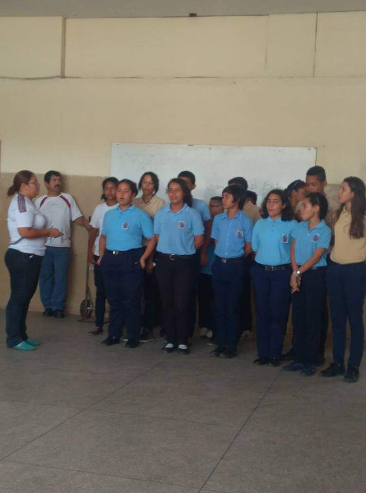
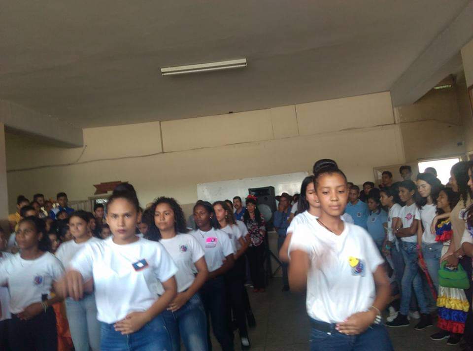
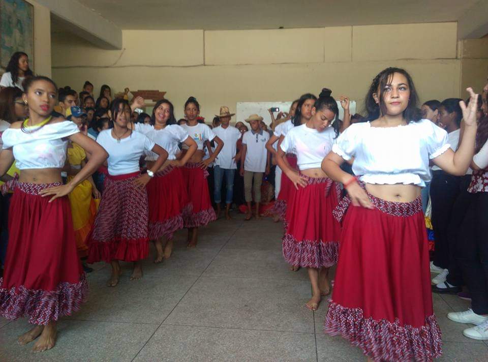
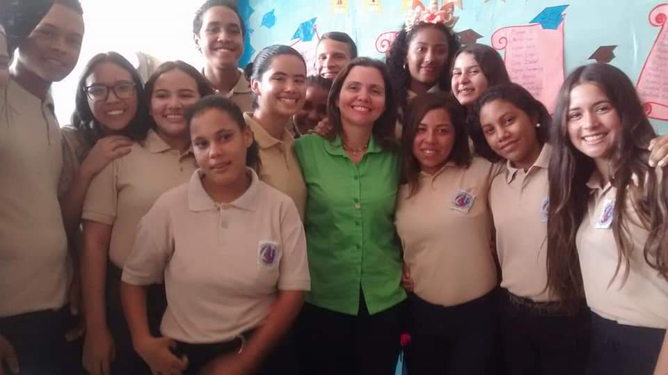
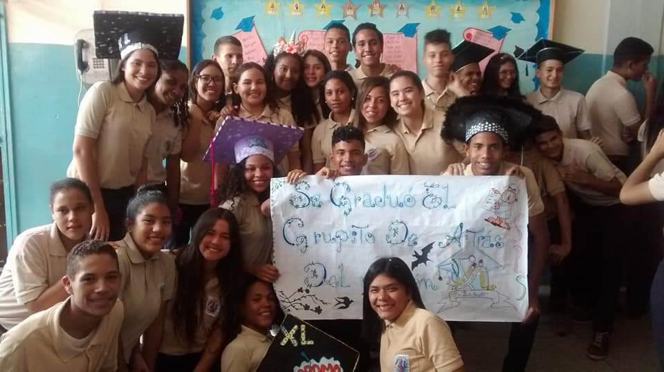
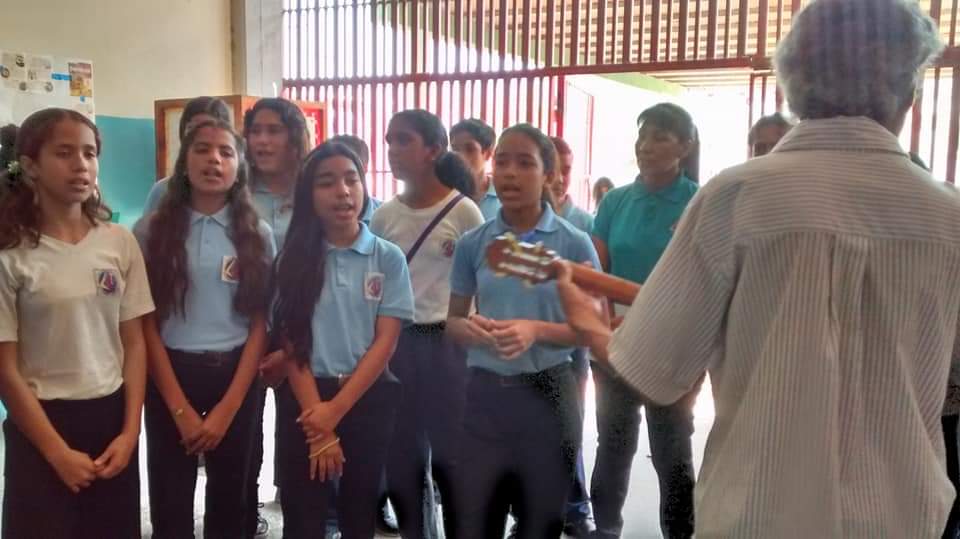
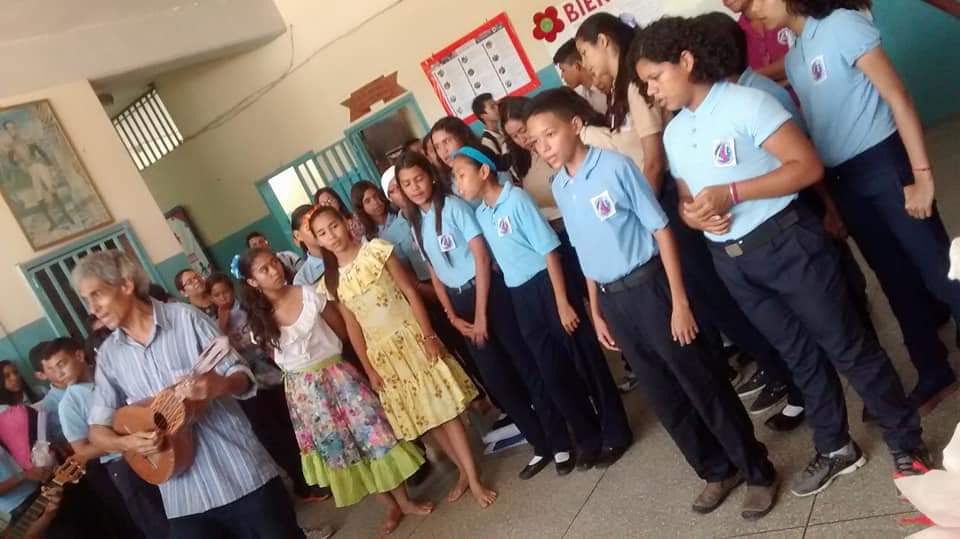
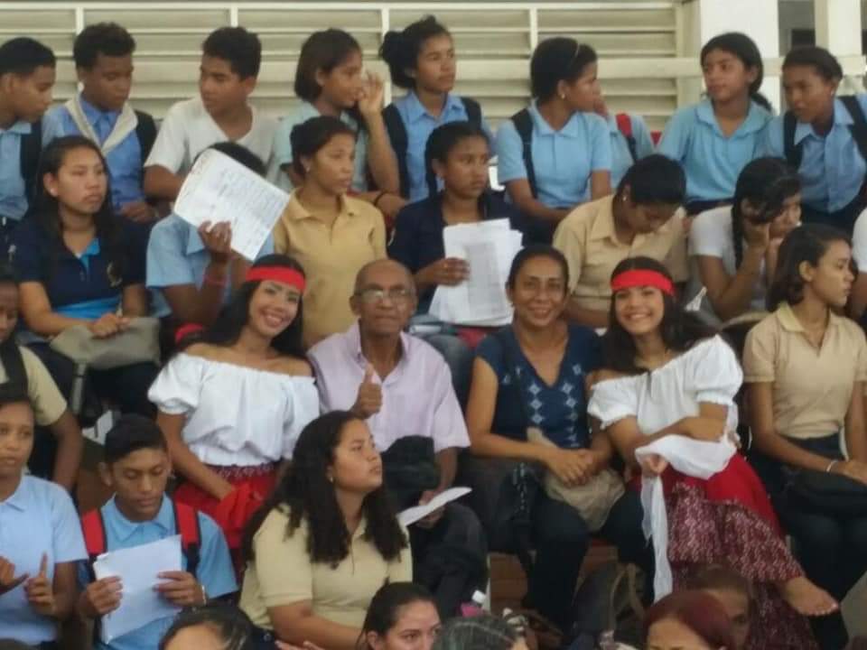
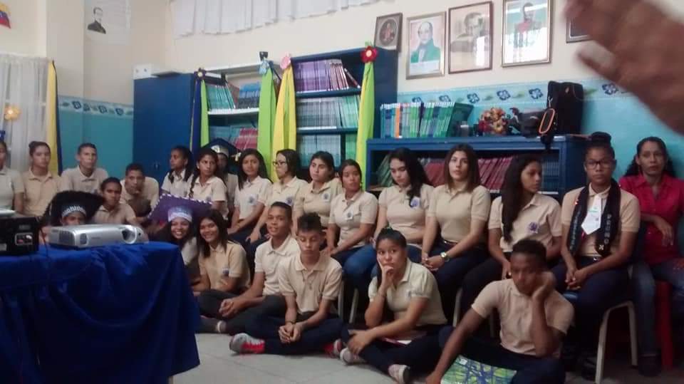
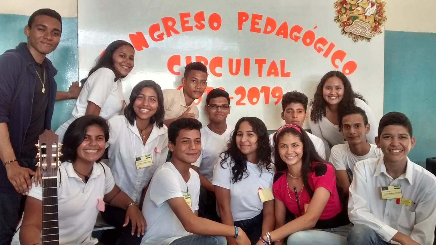
Public Bolivarian High School Luis Razzetti in Barcelona, the state's capital:
My Updated 23andme Results (2021)
My Updated AncestryDNA Results (2022)
My Global25 Coordinates (2020)
An Epic Thread about me opened by Profield
There are currently 1 users browsing this thread. (0 members and 1 guests)
 Latin America
Latin America
Latin America
Latin America
Latin America
Latin America
Latin America
Latin America
Latin America
 Posting Permissions


 Reply With Quote
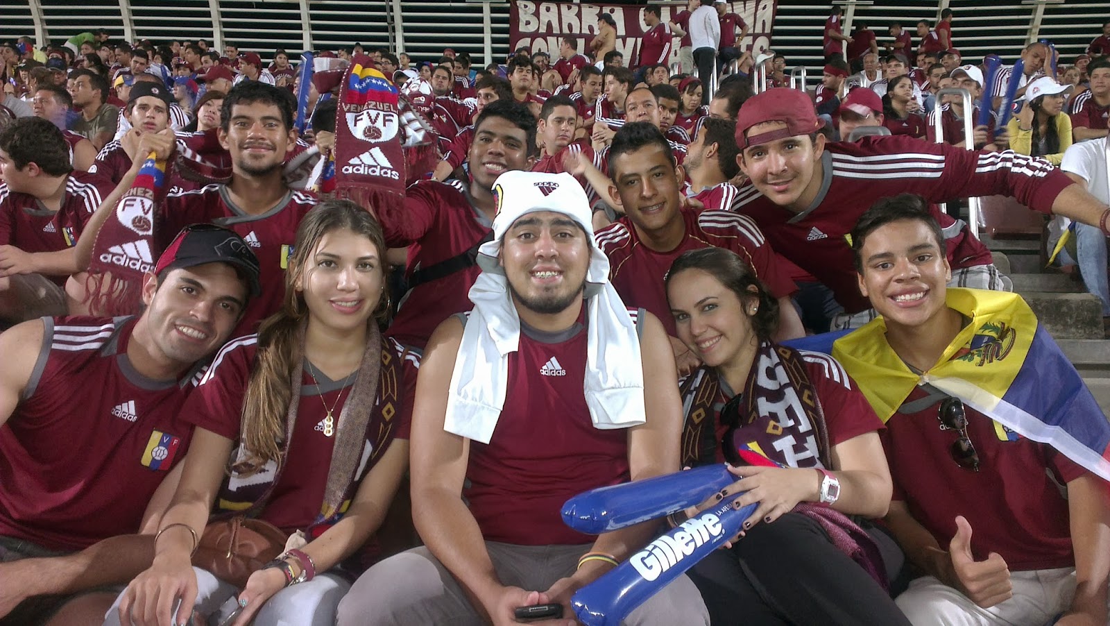


Bookmarks