


 England
0


| Thumbs Up/Down |
| Received: 25,613/313 Given: 27,909/500 |
Originally Posted by Sundqvist

Torbay isn't in Cornwall but in the neighbouring county of Devon. https://www.theapricity.com/forum/sh...n-West-Country
The beaches along the south-west coast get busy and overcrowded during the summer with lots of tourists.
❀♫ ღ ♬ ♪ And the angle of the sun changed it all. ❀¸.*¨♥✿ 🎶
oops, but looks so nice there
| Thumbs Up/Down |
| Received: 25,613/313 Given: 27,909/500 |
I've never visited the Meditteranean countries and have no intention to, but people say the Med sea is a calm sea.
The seas in the south-west of England where I grew up were often choppy with waves... so we have a lot of windbreakers placed out into the sea along the beaches in the south west due to coastal erosion and falling rocks from the cliffs.
People say the seas here feel cold, whereas people say the Med sea feels warm or hot.
The south-west of England is the second most windiest area of the UK, after western Scotland.
The weather is often humid (which makes the winters feel colder than they are in dry cold weather in other countries.) The weather also changes a lot in the Isles. You may get a few cloud-free days or even weeks in mid summer, but drizzle and rain and clouds still occurs in the summer months, even in the south-west.
The reason why it's often cloudy in the Isles: https://physics.stackexchange.com/qu...land-so-cloudy
Storms and flooding aren't unusual in CornwallThe south-west is the second most exposed area of the United Kingdom; second to western Scotland. The strong winds are caused by deep depressions across or close to the British Isles. Winds are stronger in the winter-half year, as the depressions' strength and frequency increase. The lightest mean wind speeds are in summer. The speed of peak gusts and mean wind speed follow a similar pattern throughout the year.
Mean wind speeds are generally lower to the north-east of the region and in inland areas. Yeovilton, lowland Somerset, has a mean wind speed that is two thirds that of St. Mawgan in coastal Cornwall. An increase in altitude in inland areas generally increases the mean wind speed; similar wind speeds are recorded on the highest parts of Exmoor and Dartmoor as on the coast.
The majority, and the strongest, of the winds are from the south-west and north-east as Atlantic depressions pass from west to east over the United Kingdom. When an Atlantic depression reaches the United Kingdom, winds usually blow from the south or south-west, and they change to west or north-west when the depression leaves. If a depression passes along the English Channel, strong winds can occur from the east or north-east. Due to anticyclogenesis over Scandinavia, the majority of winds in Spring are from the north-east. Coastal areas of the south-west usually experience calm or very light winds that do not have a classifiable wind direction less than 6% of the time; this figure is 15% in the north-east and inland areas.
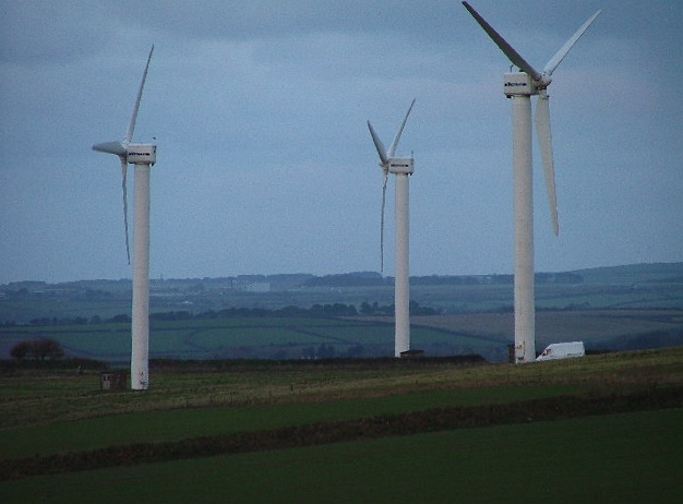
Carland Cross Wind Farm, Cornwall
Islands and exposed headlands have the highest number of days per year of gale-force winds (averaged out over ten consecutive minutes). A gale-force wind is defined as being at least 34 knots (63 km/h; 39 mph), which is 8 on the modern Beaufort scale. Gales are recorded approximately 24 days per year in the Isles of Scilly and coastal Cornwall. Further north-east and further inland, the number of days decreases. Plymouth, coastal Devon, receives 16 days; Yeovilton, Somerset, receives seven; and Long Ashton, north-west Somerset, receives four. Wind speeds can vary on local topography: wooded or urban areas sheltered by hills receive fewer days of gales and lower wind speeds.
On 15 December 1979, there were gusts of 91 knots (169 km/h; 105 mph) at Lizard Point, Cornwall 99 knots (183 km/h; 114 mph) at St Mary's, Isles of Scilly and 103 knots (191 km/h; 119 mph) at Gwennap Head, Cornwall. Widespread winds from the Burns' Day storm on 25 January 1990 overturned vehicles and damaged buildings. It caused the highest wind speed during the 1971–2001 period to be recorded in two stations: 84 knots (156 km/h; 97 mph) at Plymouth and 85 knots (157 km/h; 98 mph) at St Mawgan. 79 knots (146 km/h; 91 mph) was recorded on top of a building in Bristol as well as 74 knots (137 km/h; 85 mph) at Exeter International Airport and 68 knots (126 km/h; 78 mph) at Yeovilton. At Plymouth, the maximum hourly mean speed was 60 knots (110 km/h; 69 mph) and at Yeovilton, 45 knots (83 km/h; 52 mph).[12] The Bristol Channel floods on 30 January 1607 apparently caused "many thousand" deaths and may have destroyed several small harbours. The cause of it is disputed to be either a European windstorm or a tsunami.
https://en.wikipedia.org/wiki/Climat...t_England#Wind
Windsurfing in Cornwall
Flooding in Bournemouth, Dorset, south-west England
Floods in Cornwall
Last edited by ♥ Lily ♥; 11-09-2019 at 06:19 PM.
❀♫ ღ ♬ ♪ And the angle of the sun changed it all. ❀¸.*¨♥✿ 🎶


| Thumbs Up/Down |
| Received: 25,024/80 Given: 16,464/57 |
Beautiful!
According to Gedmatch Cornish is what I am most ethnically similar to ^_^
Whats done in darkness will come to light
| Thumbs Up/Down |
| Received: 25,613/313 Given: 27,909/500 |
❀♫ ღ ♬ ♪ And the angle of the sun changed it all. ❀¸.*¨♥✿ 🎶
| Thumbs Up/Down |
| Received: 25,613/313 Given: 27,909/500 |
❀♫ ღ ♬ ♪ And the angle of the sun changed it all. ❀¸.*¨♥✿ 🎶
| Thumbs Up/Down |
| Received: 25,613/313 Given: 27,909/500 |
❀♫ ღ ♬ ♪ And the angle of the sun changed it all. ❀¸.*¨♥✿ 🎶
| Thumbs Up/Down |
| Received: 25,613/313 Given: 27,909/500 |
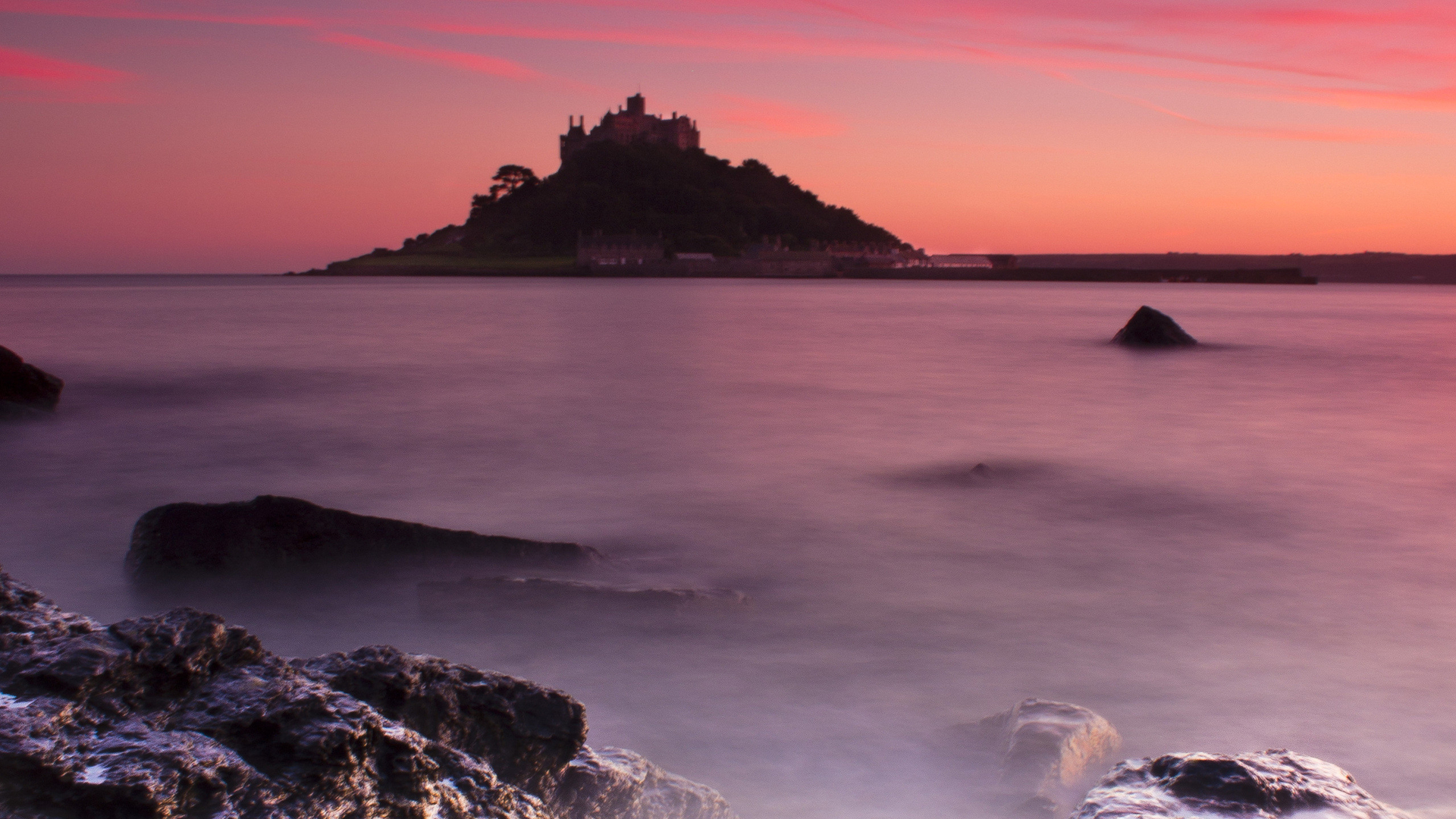
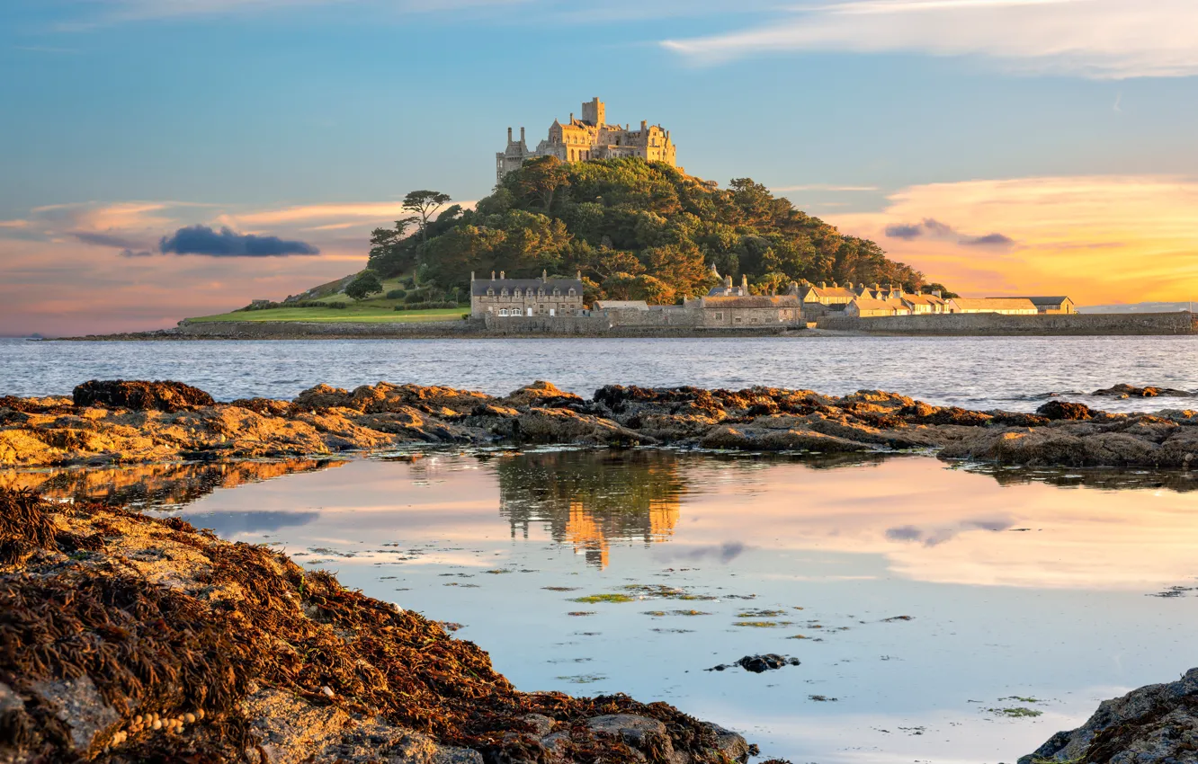
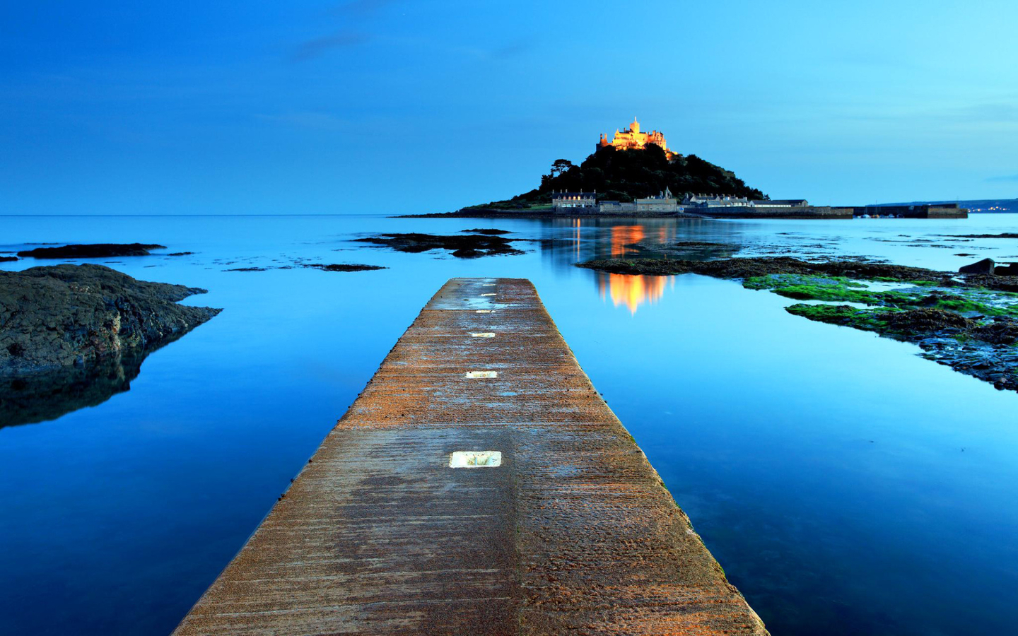
St Michael's Mount is a tidal island in Mount's Bay, Cornwall, England, United Kingdom.
The island is a civil parish and is linked to the town of Marazion by a man-made causeway of granite setts, passable between mid-tide and low water. It is managed by the National Trust, and the castle and chapel have been the home of the St Aubyn family since approximately 1650.
Historically, St Michael's Mount was a Cornish counterpart of Mont Saint-Michel in Normandy, France (with which it shares the same tidal island characteristics and the same conical shape, though it is much smaller, at 57 acres, than Mont St Michel which covers 247 acres), when it was given to the Benedictine religious order of Mont Saint-Michel by Edward the Confessor in the 11th century.
St Michael's Mount is one of 43 unbridged tidal islands that one can walk to from mainland Britain. Part of the island was designated as a Site of Special Scientific Interest in 1995 for its geology.
Last edited by ♥ Lily ♥; 12-27-2019 at 02:04 AM.
❀♫ ღ ♬ ♪ And the angle of the sun changed it all. ❀¸.*¨♥✿ 🎶
There are currently 1 users browsing this thread. (0 members and 1 guests)
 United Kingdom
 Posting Permissions


Bookmarks